
Magnitude |
:2.5 |
| Date & Time (UTC) | 2015-10-23 19:52:28.4 |
| Date & Time (Local) | 1394/8/1 23:22:28.4 |
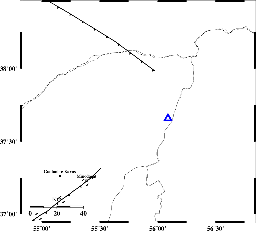
| Location | Lat:37.702 Lon: 55.831 |
| Region | Golestan Province, 47 km North-East of Kalaleh |
Nearest Cities |
|
| 12 km North West of Golidagh, Golestan Province | |
| 25 km South West of Moravehtappeh, Golestan Province | |
| 27 km North East of Pashikmar, Golestan Province | |
| 31 km East of Qareh aghaj, Golestan Province | |
| 39 km North East of Ajen sangarli, Golestan Province | |
| Depth | 10 km |
| Agency | |
Faults within 150 km: |
|
| ROBATE_QARABIL_F (Length: 168 km) , Distance to epicenter: 63 km | |
| JAJARAM_F (Length: 77 km) , Distance to epicenter: 95 km | |
| ESFARAYEN_F (Length: 111 km) , Distance to epicenter: 105 km | |
| Number of Phases | 5 |
| RMS | 0 |
| Number of Stations | 3 |
| Error in Latitude | >2.4 km |
| Error in Longitude | 3.2 km |
| Error in Depth | 7.8 km |
Download waveform in seisan format
to download seisan software Click here
to access information about IIEES stations Click here
Amplitude | ||||||||
| UID | Agency | Station | Component | Amplitude | Period | Arrival Time | Proccessing Time | Signal Clip |
| 102009 | IIEES | MRVT | N | 1328.7 | 0.3 | 2015-10-23 19:52:36 | 2015-10-25 11:28:00 | n |
| 102010 | IIEES | MRVT | E | 1004.3 | 0.06 | 2015-10-23 19:52:36 | 2015-10-25 11:28:00 | n |
| 102011 | IIEES | BJRD | E | 52.2 | 0.24 | 2015-10-23 19:53:13 | 2015-10-25 11:28:00 | n |
Phase | ||||||||||||
| Agency | Station | Component | Phase Type | Phase Quality | First Motion | Observed Arrival Time | Time Residual | Loc. Flag | Input Weight | Distance | Azimuth | |
| IIEES | MRVT | Z | Pg | E | 2015-10-23 19:52:32 | 0 | y | 23.2 | 102 | |||
| IIEES | BJRD | Z | Pg | E | 2015-10-23 19:52:52 | -0.02 | y | 139 | 90 | |||
| IIEES | BJRD | E | Sg | E | 2015-10-23 19:53:10 | 0.01 | y | 139 | 90 | |||
| IIEES | SHRO | Z | Pg | E | 2015-10-23 19:53:00 | 0.02 | y | 189 | 175 | |||
| IIEES | SHRO | E | Sg | E | 2015-10-23 19:53:24 | -0.01 | y | 189 | 175 | |||