
| Prel. Rep. | Date | Time(UTC) | Time(Local) | Lat. | Lon. | Depth | Mag. | Region | Waveform |
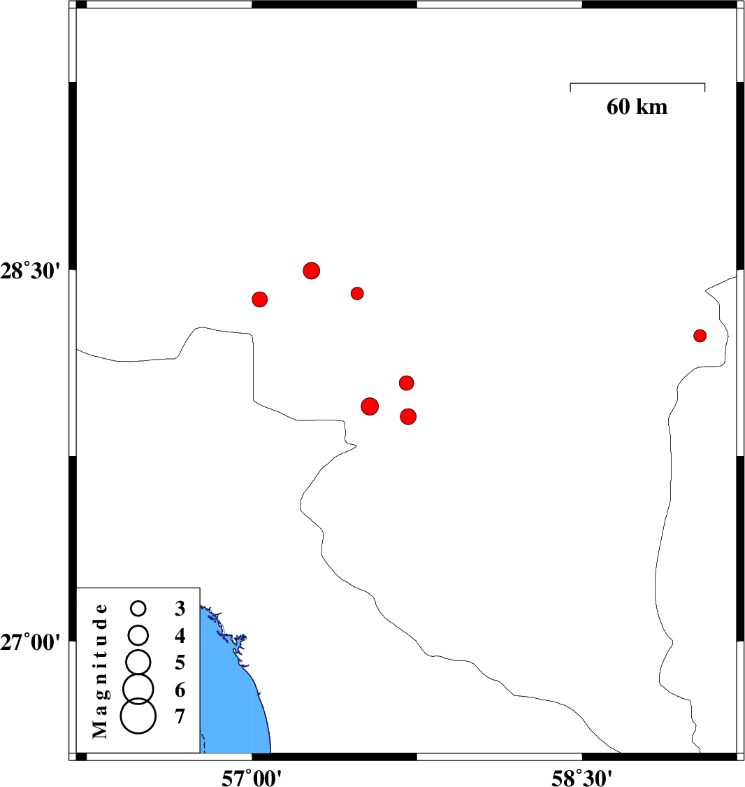
| 2015/08/30 | 00:23:57.3 | 04:53:57.3 | 28.044 | 57.702 | 14 | ML:2.9 | Kerman Province, 10 km of Kahnuj | ||
| 2015/08/27 | 07:24:58.8 | 11:54:58.8 | 28.234 | 59.036 | 14 | ML:2.6 | Kerman Province, 118 km South-East of Bam | ||
| 2015/08/24 | 19:58:34.3 | 00:28:34.3 | 28.495 | 57.27 | 16 | ML:3.4 | Kerman Province, 50 km South-West of Jiroft | ||
| 2015/08/16 | 16:03:14.0 | 20:33:14.0 | 28.404 | 57.479 | 17 | ML:2.6 | Kerman Province, 39 km South-West of Jiroft | ||
| 2015/08/13 | 00:26:04.6 | 04:56:04.6 | 27.909 | 57.71 | 14 | ML:3.2 | Kerman Province, 5 km of Kahnuj | ||
| 2015/08/12 | 22:10:38.0 | 02:40:38.0 | 27.95 | 57.536 | 14 | ML:3.5 | Kerman Province, 16 km -West of Kahnuj | ||
| 2015/08/11 | 02:59:49.6 | 07:29:49.6 | 28.38 | 57.035 | 16 | ML:3.1 | Kerman Province, 76 km South-West of Jiroft |