
Magnitude |
:4.3 |
| Date & Time (UTC) | 2014-05-12 16:42:21.7 |
| Date & Time (Local) | 1393/2/22 21:12:21.7 |
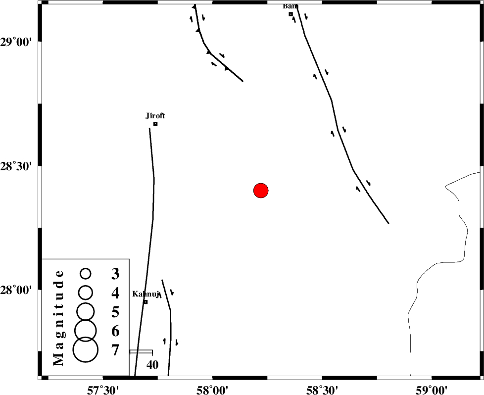
| Location | Lat:28.4 Lon: 58.22 |
| Region | Kerman Province, 56 km South-East of Jiroft |
Nearest Cities |
|
| 7 km North of Mardehak, Kerman Province | |
| 26 km South East of Dahane-ye gomrokan, Kerman Province | |
| 27 km East of Dosari, Kerman Province | |
| 35 km East of Aliabad-e qadiri, Kerman Province | |
| 39 km East of Khesrabad, Kerman Province | |
| Depth | 15 km |
| Agency | |
Faults within 150 km: |
|
| BAM_F (Length: 118 km) , Distance to epicenter: 42 km | |
| SABZEVARAN_F (Length: 190 km) , Distance to epicenter: 48 km | |
| GOWK_F (Length: 152 km) , Distance to epicenter: 50 km | |
| Number of Phases | 4 |
| RMS | 0.3 |
| Number of Stations | 5 |
| Error in Latitude | >3.8 km |
| Error in Longitude | 2.5 km |
| Error in Depth | 0 km |
Download waveform in seisan format
to download seisan software Click here
to access information about IIEES stations Click here
Amplitude | ||||||||
| UID | Agency | Station | Component | Amplitude | Period | Arrival Time | Proccessing Time | Signal Clip |
| 92411 | IIEES | KRBR | E | 2101.1 | 0.28 | 2014-05-12 16:43:26 | 2014-05-12 06:04:00 | n |
Phase | ||||||||||||
| Agency | Station | Component | Phase Type | Phase Quality | First Motion | Observed Arrival Time | Time Residual | Loc. Flag | Input Weight | Distance | Azimuth | |
| IIEES | BNDS | Z | Pn | E | 2014-05-12 16:42:58 | 0.14 | y | 230 | 242 | |||
| IIEES | ZHSF | Z | Pn | E | 2014-05-12 16:43:04 | 0.36 | y | 283 | 61 | |||
| IIEES | CHBR | Z | Pn | E | 2014-05-12 16:43:16 | -0.25 | y | 383 | 144 | |||
| IIEES | BSRN | Z | Pn | E | 2014-05-12 16:43:19 | -0.35 | y | 405 | 12 | |||