
Magnitude |
:3.2 |
| Date & Time (UTC) | 2013-04-09 06:18:57.7 |
| Date & Time (Local) | 1392/1/20 10:48:57.7 |
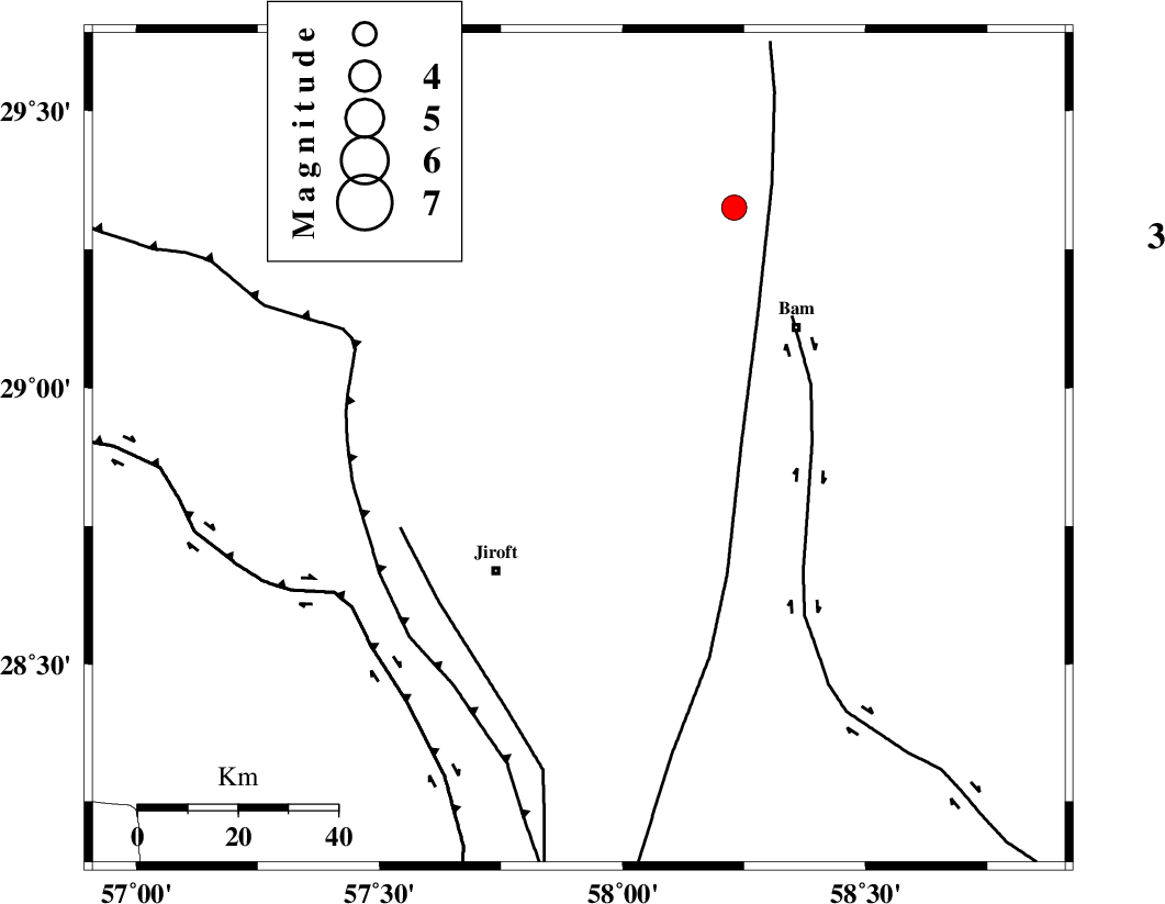
| Location | Lat:28.89 Lon: 57.91 |
| Region | Kerman Province, 30 km North-East of Jiroft |
Nearest Cities |
|
| 3 km of Mohammadabad, Kerman Province | |
| 6 km North of Saghdar, Kerman Province | |
| 23 km North of Mijan-e sofla, Kerman Province | |
| 30 km North East of Jiroft, Kerman Province | |
| 32 km South East of Delfard, Kerman Province | |
| Depth | 14 km |
| Agency | |
Faults within 150 km: |
|
| GOWK_F (Length: 152 km) , Distance to epicenter: 10 km | |
| SABZEVARAN_F (Length: 190 km) , Distance to epicenter: 33 km | |
| BAM_F (Length: 118 km) , Distance to epicenter: 52 km | |
| Number of Phases | 6 |
| RMS | 0.2 |
| Number of Stations | 6 |
| Error in Latitude | >5.2 km |
| Error in Longitude | 3.9 km |
| Error in Depth | 9.6 km |
Download waveform in seisan format
to download seisan software Click here
to access information about IIEES stations Click here
Amplitude | ||||||||
| UID | Agency | Station | Component | Amplitude | Period | Arrival Time | Proccessing Time | Signal Clip |
| 88436 | IIEES | KRBR | N | 313.8 | 0.36 | 2013-04-09 06:19:50 | 2013-04-09 08:06:00 | n |
| 88437 | IIEES | KRBR | E | 279.1 | 0.19 | 2013-04-09 06:19:52 | 2013-04-09 08:06:00 | n |
| 88438 | IIEES | BSRN | E | 61.8 | 0.32 | 2013-04-09 06:20:41 | 2013-04-09 08:06:00 | n |
Phase | ||||||||||||
| Agency | Station | Component | Phase Type | Phase Quality | First Motion | Observed Arrival Time | Time Residual | Loc. Flag | Input Weight | Distance | Azimuth | |
| IIEES | KRBR | Z | Pg | E | 2013-04-09 06:19:24 | -0.41 | y | 165 | 318 | |||
| IIEES | KRBR | E | Sg | E | 2013-04-09 06:19:45 | 0.21 | y | 165 | 318 | |||
| IIEES | ZHSF | Z | Pn | E | 2013-04-09 06:19:41 | 0.06 | y | 290 | 73 | |||
| IIEES | GHIR | Z | Pn | E | 2013-04-09 06:20:06 | 0.15 | y | 486 | 263 | |||
| IIEES | TABS | Z | P | E | 2013-04-09 06:20:11 | 0.03 | y | 533 | 352 | |||
| IIEES | SHRT | Z | Pn | E | 2013-04-09 06:20:16 | 0.03 | y | 574 | 23 | |||