
Magnitude |
:2.1 |
| Date & Time (UTC) | 2015-10-13 01:25:52.2 |
| Date & Time (Local) | 1394/7/21 04:55:52.2 |
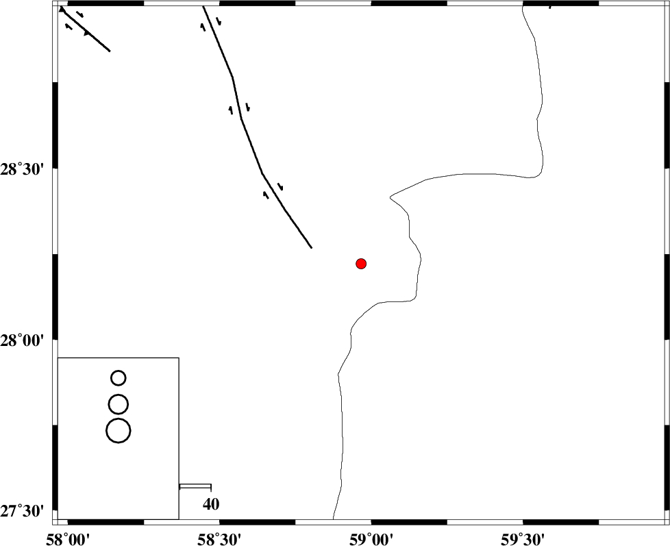
| Location | Lat:28.222 Lon: 58.966 |
| Region | Kerman Province, 115 km South-East of Bam |
Nearest Cities |
|
| 49 km North East of Borj-e abbasabad, Kerman Province | |
| 54 km South of Hoseynabad, Kerman Province | |
| 56 km South of Mohammadabad-e gonbaki, Kerman Province | |
| 72 km South of Void, Kerman Province | |
| 79 km South East of Mardehak, Kerman Province | |
| Depth | 15 km |
| Agency | |
Faults within 150 km: |
|
| BAM_F (Length: 118 km) , Distance to epicenter: 17 km | |
| KANURAK_F (Length: 135 km) , Distance to epicenter: 102 km | |
| GOWK_F (Length: 152 km) , Distance to epicenter: 106 km | |
| Number of Phases | 6 |
| RMS | 0.2 |
| Number of Stations | 4 |
| Error in Latitude | >3.4 km |
| Error in Longitude | 2.1 km |
| Error in Depth | 7.1 km |
Download waveform in seisan format
to download seisan software Click here
to access information about IIEES stations Click here
Amplitude | ||||||||
| UID | Agency | Station | Component | Amplitude | Period | Arrival Time | Proccessing Time | Signal Clip |
| 101698 | IIEES | KRBR | E | 9 | 0.27 | 2015-10-13 01:27:21 | 2015-10-13 07:07:00 | n |
| 101699 | IIEES | KRBR | N | 7.4 | 0.38 | 2015-10-13 01:27:26 | 2015-10-13 07:07:00 | n |
Phase | ||||||||||||
| Agency | Station | Component | Phase Type | Phase Quality | First Motion | Observed Arrival Time | Time Residual | Loc. Flag | Input Weight | Distance | Azimuth | |
| IIEES | ZHSF | Z | Pn | E | 2015-10-13 01:26:29 | 0.38 | y | 234 | 48 | |||
| IIEES | ZHSF | N | Sg | E | 2015-10-13 01:26:58 | -0.12 | y | 234 | 48 | |||
| IIEES | KRBR | Z | Pn | E | 2015-10-13 01:26:35 | -0.18 | y | 290 | 313 | |||
| IIEES | KRBR | E | Sg | E | 2015-10-13 01:27:14 | 0.12 | y | 290 | 313 | |||
| IIEES | CHBR | Z | Pn | E | 2015-10-13 01:26:40 | -0.04 | y | 328 | 152 | |||
| IIEES | BSRN | Z | Pn | E | 2015-10-13 01:26:51 | -0.21 | y | 415 | 2 | |||