
Magnitude |
:2.7 |
| Date & Time (UTC) | 2015-05-08 03:34:22.6 |
| Date & Time (Local) | 1394/2/18 08:04:22.6 |
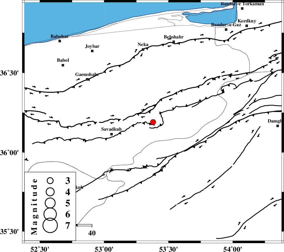
| Location | Lat:36.19 Lon: 53.38 |
| Region | Mazandaran Province, 30 km East of Pol-E-Sefid |
Nearest Cities |
|
| 15 km West of Kiasar, Mazandaran Province | |
| 15 km South of Khalkhil, Mazandaran Province | |
| 19 km North East of Sangdeh, Mazandaran Province | |
| 29 km West of Talma darreh, Mazandaran Province | |
| 30 km North East of Pol-E-Sefid, Mazandaran Province | |
| Depth | 14 km |
| Agency | |
Faults within 150 km: |
|
| N_ALBORZ_F (Length: 360 km) , Distance to epicenter: 11 km | |
| DAMGHAN_F (Length: 95 km) , Distance to epicenter: 41 km | |
| KHAZAR_F (Length: 523 km) , Distance to epicenter: 45 km | |
| Number of Phases | 6 |
| RMS | 0.1 |
| Number of Stations | 4 |
| Error in Latitude | >7.2 km |
| Error in Longitude | 3.1 km |
| Error in Depth | 6.4 km |
Download waveform in seisan format
to download seisan software Click here
to access information about IIEES stations Click here
Amplitude | ||||||||
| UID | Agency | Station | Component | Amplitude | Period | Arrival Time | Proccessing Time | Signal Clip |
| 95603 | IIEES | THKV | N | 52.9 | 0.56 | 2015-05-08 03:35:29 | 2015-05-08 05:23:00 | n |
Phase | ||||||||||||
| Agency | Station | Component | Phase Type | Phase Quality | First Motion | Observed Arrival Time | Time Residual | Loc. Flag | Input Weight | Distance | Azimuth | |
| IIEES | DAMV | Z | Pg | E | 2015-05-08 03:34:46 | -0.06 | y | 141 | 244 | |||
| IIEES | CHTH | Z | P | E | 2015-05-08 03:34:55 | 0 | y | 205 | 262 | |||
| IIEES | CHTH | E | Sg | E | 2015-05-08 03:35:21 | -0.08 | y | 205 | 262 | |||
| IIEES | THKV | Z | Pn | E | 2015-05-08 03:34:58 | 0.23 | y | 227 | 263 | |||
| IIEES | THKV | N | Sg | E | 2015-05-08 03:35:27 | 0 | y | 227 | 263 | |||
| IIEES | MRVT | Z | Pn | E | 2015-05-08 03:35:06 | -0.1 | y | 292 | 55 | |||