
Magnitude |
:2.9 |
| Date & Time (UTC) | 2014-12-12 22:14:05.7 |
| Date & Time (Local) | 1393/9/22 01:44:05.7 |
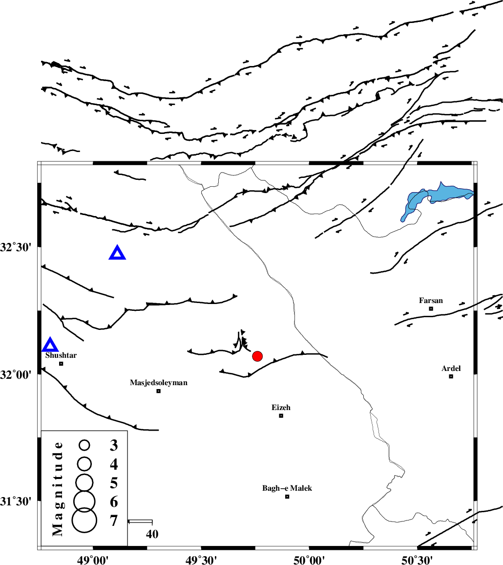
| Location | Lat:32.07 Lon: 49.76 |
| Region | Khoozestan Province, 28 km North-West of Izeh |
Nearest Cities |
|
| 10 km North of Torshak, Khoozestan Province | |
| 23 km North of Rasvand, Khoozestan Province | |
| 28 km North West of Izeh, Khoozestan Province | |
| 31 km South East of Paabshalal, Khoozestan Province | |
| 31 km North of Chenarestan, Khoozestan Province | |
| Depth | 14 km |
| Agency | |
Faults within 150 km: |
|
| MFF2 (Length: 205 km) , Distance to epicenter: 9 km | |
| ZARDKUH_F (Length: 139 km) , Distance to epicenter: 38 km | |
| DOPOLAN_F (Length: 107 km) , Distance to epicenter: 47 km | |
| Number of Phases | 4 |
| RMS | 0 |
| Number of Stations | 4 |
| Error in Latitude | >10.2 km |
| Error in Longitude | 10 km |
| Error in Depth | 6.8 km |
Download waveform in seisan format
to download seisan software Click here
to access information about IIEES stations Click here
Amplitude | ||||||||
| UID | Agency | Station | Component | Amplitude | Period | Arrival Time | Proccessing Time | Signal Clip |
| 94508 | IIEES | SHGR | E | 388 | 0.24 | 2014-12-12 22:14:36 | 2014-12-12 10:33:00 | n |
| 94509 | IIEES | SHGR | N | 438.3 | 0.32 | 2014-12-12 22:14:36 | 2014-12-12 10:33:00 | n |
Phase | ||||||||||||
| Agency | Station | Component | Phase Type | Phase Quality | First Motion | Observed Arrival Time | Time Residual | Loc. Flag | Input Weight | Distance | Azimuth | |
| IIEES | SHGR | Z | Pg | E | 2014-12-12 22:14:21 | 0 | y | 90.2 | 273 | |||
| IIEES | KHMZ | Z | Pg | E | 2014-12-12 22:14:36 | -0.01 | y | 186 | 6 | |||
| IIEES | ASAO | Z | Pn | E | 2014-12-12 22:14:48 | 0.07 | y | 276 | 5 | |||
| IIEES | GHVR | Z | Pn | E | 2014-12-12 22:14:50 | -0.06 | y | 301 | 27 | |||