
Magnitude |
:3.7 |
| Date & Time (UTC) | 2014-04-25 01:48:29.7 |
| Date & Time (Local) | 1393/2/5 06:18:29.7 |
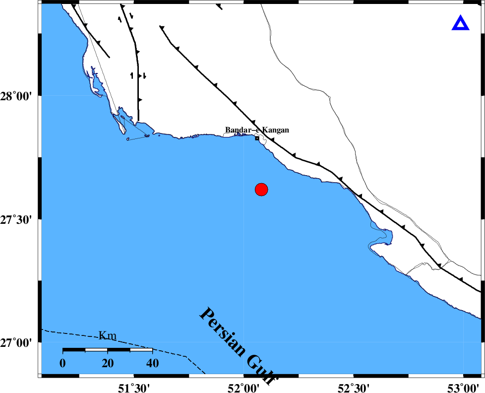
| Location | Lat:27.62 Lon: 52.08 |
| Region | Persian Gulf, 24 km South of Bandar-e kangan |
Nearest Cities |
|
| 23 km South of Bandar-e kangan, Bushehr Province | |
| 26 km West of Bandar-e taheri, Bushehr Province | |
| 33 km South West of Jam, Bushehr Province | |
| 47 km South of Riz, Bushehr Province | |
| 55 km North West of Bandar-e asaluyeh, Bushehr Province | |
| Depth | 33 km |
| Agency | |
Faults within 150 km: |
|
| MFF3 (Length: 292 km) , Distance to epicenter: 21 km | |
| BORAZJAN_F (Length: 168 km) , Distance to epicenter: 63 km | |
| MFF5 (Length: 74 km) , Distance to epicenter: 83 km | |
| Number of Phases | 8 |
| RMS | 0.2 |
| Number of Stations | 6 |
| Error in Latitude | >6.8 km |
| Error in Longitude | 2.8 km |
| Error in Depth | 5.2 km |
Download waveform in seisan format
to download seisan software Click here
to access information about IIEES stations Click here
Amplitude | ||||||||
| UID | Agency | Station | Component | Amplitude | Period | Arrival Time | Proccessing Time | Signal Clip |
| 92264 | IIEES | GHIR | E | 1682.9 | 0.32 | 2014-04-25 01:49:07 | 2014-04-25 03:13:00 | n |
Phase | ||||||||||||
| Agency | Station | Component | Phase Type | Phase Quality | First Motion | Observed Arrival Time | Time Residual | Loc. Flag | Input Weight | Distance | Azimuth | |
| IIEES | GHIR | Z | Pg | E | 2014-04-25 01:48:49 | -0.08 | y | 116 | 50 | |||
| IIEES | GHIR | E | Sg | E | 2014-04-25 01:49:03 | -0.06 | y | 116 | 50 | |||
| IIEES | AHRM | Z | Pg | E | 2014-04-25 01:48:55 | -0.03 | y | 159 | 331 | |||
| IIEES | AHRM | N | Sg | E | 2014-04-25 01:49:14 | 0.17 | y | 159 | 331 | |||
| IIEES | KRBR | Z | Pn | E | 2014-04-25 01:49:41 | 0.51 | y | 527 | 59 | |||
| IIEES | YZKH | Z | Pn | E | 2014-04-25 01:49:48 | -0.08 | y | 582 | 24 | |||
| IIEES | KHMZ | Z | Pn | E | 2014-04-25 01:50:03 | -0.4 | y | 709 | 344 | |||
| IIEES | GHVR | Z | Pn | E | 2014-04-25 01:50:10 | -0.24 | y | 765 | 354 | |||