
Magnitude |
:3.4 |
| Date & Time (UTC) | 2014-03-20 21:15:36.0 |
| Date & Time (Local) | 1393/1/1 00:45:36.0 |
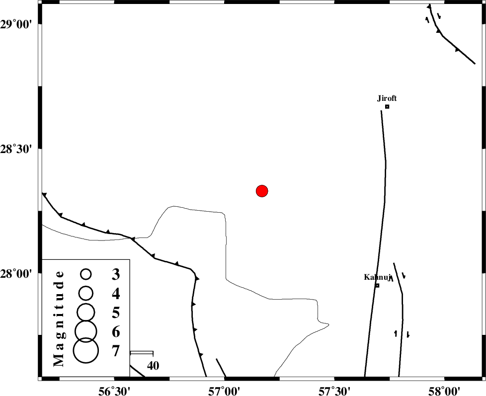
| Location | Lat:28.33 Lon: 57.17 |
| Region | Kerman Province, 66 km North-West of Kahnuj |
Nearest Cities |
|
| 21 km North West of Hurpasefid, Kerman Province | |
| 29 km East of Sarkhan, Kerman Province | |
| 31 km North West of Faryab, Kerman Province | |
| 35 km North West of Mehrueye-e paeen, Kerman Province | |
| 39 km North West of Bolock, Kerman Province | |
| Depth | 15 km |
| Agency | |
Faults within 150 km: |
|
| MAIN_ZAGROS_R_F (Length: 1106 km) , Distance to epicenter: 47 km | |
| SABZEVARAN_F (Length: 190 km) , Distance to epicenter: 55 km | |
| JIROFT_F (Length: 144 km) , Distance to epicenter: 67 km | |
| Number of Phases | 3 |
| RMS | 0 |
| Number of Stations | 3 |
| Error in Latitude | >1.7 km |
| Error in Longitude | 2.5 km |
| Error in Depth | 0 km |
Download waveform in seisan format
to download seisan software Click here
to access information about IIEES stations Click here
Amplitude | ||||||||
| UID | Agency | Station | Component | Amplitude | Period | Arrival Time | Proccessing Time | Signal Clip |
| 92031 | IIEES | BNDS | E | 629 | 0.6 | 2014-03-20 21:16:22 | 2014-03-20 10:37:00 | n |
| 92032 | IIEES | KRBR | N | 388.4 | 0.48 | 2014-03-20 21:16:37 | 2014-03-20 10:37:00 | n |
Phase | ||||||||||||
| Agency | Station | Component | Phase Type | Phase Quality | First Motion | Observed Arrival Time | Time Residual | Loc. Flag | Input Weight | Distance | Azimuth | |
| IIEES | BNDS | Z | Pg | E | 2014-03-20 21:15:59 | 0 | y | 142 | 224 | |||
| IIEES | KRBR | Z | Pg | E | 2014-03-20 21:16:07 | 0 | y | 188 | 348 | |||
| IIEES | ZHSF | Z | Pn | E | 2014-03-20 21:16:30 | 0 | y | 379 | 67 | |||