
Magnitude |
:2.8 |
| Date & Time (UTC) | 2014-02-15 12:28:08.3 |
| Date & Time (Local) | 1392/11/26 15:58:08.3 |
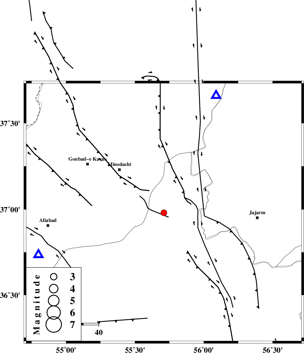
| Location | Lat:36.98 Lon: 55.71 |
| Region | Semnan Province, 40 km South-East of Minodasht |
Nearest Cities |
|
| 7 km of Qaleh qafeh, Semnan Province | |
| 9 km of Nardin, Semnan Province | |
| 15 km South of Rezvan, Semnan Province | |
| 20 km South East of Duzin, Golestan Province | |
| 20 km East of Qale-ye qafeh, Golestan Province | |
| Depth | 29 km |
| Agency | |
Faults within 150 km: |
|
| ROBATE_QARABIL_F (Length: 168 km) , Distance to epicenter: 10 km | |
| JAJARAM_F (Length: 77 km) , Distance to epicenter: 41 km | |
| SHAVAR_F (Length: 87 km) , Distance to epicenter: 50 km | |
| Number of Phases | 5 |
| RMS | 0 |
| Number of Stations | 6 |
| Error in Latitude | >3.4 km |
| Error in Longitude | 7.1 km |
| Error in Depth | 3.2 km |
Download waveform in seisan format
to download seisan software Click here
to access information about IIEES stations Click here
Amplitude | ||||||||
| UID | Agency | Station | Component | Amplitude | Period | Arrival Time | Proccessing Time | Signal Clip |
| 91800 | IIEES | BJRD | E | 100.4 | 0.32 | 2014-02-15 12:28:58 | 2014-02-15 12:52:00 | n |
| 91801 | IIEES | GRMI | E | 2.4 | 0.2 | 2014-02-15 12:29:53 | 2014-02-15 12:52:00 | n |
Phase | ||||||||||||
| Agency | Station | Component | Phase Type | Phase Quality | First Motion | Observed Arrival Time | Time Residual | Loc. Flag | Input Weight | Distance | Azimuth | |
| IIEES | SHRO | E | Pg | E | 2014-02-15 12:28:27 | -0.01 | y | 111 | 166 | |||
| IIEES | BJRD | Z | Pg | E | 2014-02-15 12:28:36 | 0.01 | y | 170 | 62 | |||
| IIEES | TABS | Z | Pn | E | 2014-02-15 12:29:03 | 0.07 | y | 391 | 160 | |||
| IIEES | YZKH | Z | Pn | E | 2014-02-15 12:29:19 | -0.03 | y | 519 | 192 | |||
| IIEES | SHRT | Z | Pn | E | 2014-02-15 12:29:23 | -0.06 | y | 557 | 130 | |||