
Magnitude |
:2.9 |
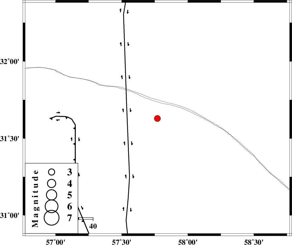
| Date & Time (UTC) | 2013-12-14 20:56:53.1 |
| Date & Time (Local) | 1392/9/24 00:26:53.1 |
| Location | Lat:31.63 Lon: 57.77 |
| Region | Kerman Province, 99 km North-East of Ravar |
Nearest Cities |
|
| 66 km South East of Hoz-e qorban, Yazd Province | |
| 98 km North East of Dehali, Kerman Province | |
| 99 km North East of Ravar, Kerman Province | |
| 123 km North East of Hejdak, Kerman Province | |
| 124 km North East of Harjand, Kerman Province | |
| Depth | 14 km |
| Agency | |
Faults within 150 km: |
|
| NAYBAND_F (Length: 258 km) , Distance to epicenter: 24 km | |
| LAKARKUH_F (Length: 138 km) , Distance to epicenter: 59 km | |
| GOLBAF_SIRCH_F (Length: 114 km) , Distance to epicenter: 122 km | |
| Number of Phases | 6 |
| RMS | 0.2 |
| Number of Stations | 4 |
| Error in Latitude | >1.7 km |
| Error in Longitude | 2 km |
| Error in Depth | 5.1 km |
Download waveform in seisan format
to download seisan software Click here
to access information about IIEES stations Click here
Amplitude | ||||||||
| UID | Agency | Station | Component | Amplitude | Period | Arrival Time | Proccessing Time | Signal Clip |
| 91213 | IIEES | KRBR | E | 101.8 | 0.4 | 2013-12-14 20:57:56 | 2013-12-14 09:53:00 | n |
Phase | ||||||||||||
| Agency | Station | Component | Phase Type | Phase Quality | First Motion | Observed Arrival Time | Time Residual | Loc. Flag | Input Weight | Distance | Azimuth | |
| IIEES | BSRN | Z | Pg | E | 2013-12-14 20:57:15 | 0.27 | y | 134 | 74 | |||
| IIEES | BSRN | N | Sg | E | 2013-12-14 20:57:31 | -0.17 | y | 134 | 74 | |||
| IIEES | KRBR | Z | Pg | E | 2013-12-14 20:57:27 | -0.16 | y | 207 | 208 | |||
| IIEES | TABS | Z | Pn | E | 2013-12-14 20:57:29 | 0.04 | y | 232 | 345 | |||
| IIEES | TABS | E | Sg | E | 2013-12-14 20:57:58 | -0.12 | y | 232 | 345 | |||
| IIEES | YZKH | Z | Pn | E | 2013-12-14 20:57:39 | 0.15 | y | 311 | 286 | |||