
Magnitude |
:4.3 |
| Date & Time (UTC) | 2012-10-29 10:51:00.2 |
| Date & Time (Local) | 1391/8/8 14:21:00.2 |
| Location | Lat:28.53 Lon: 58.58 |
| Region | Kerman Province, 68 km South-East of Bam |
Nearest Cities |
|
| 35 km South West of Mohammadabad-e gonbaki, Kerman Province | |
| 36 km South East of Kruk, Kerman Province | |
| 43 km South of Abshur-e nezamabad, Kerman Province | |
| 44 km North East of Mardehak, Kerman Province | |
| 48 km South of Qasemabad, Kerman Province | |
| Depth | 14 km |
| Agency | |
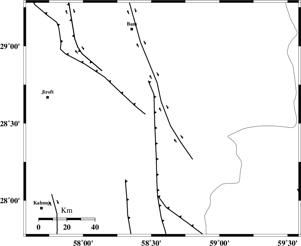
Faults within 150 km: |
|
| BAM_F (Length: 118 km) , Distance to epicenter: 8 km | |
| GOWK_F (Length: 152 km) , Distance to epicenter: 55 km | |
| SABZEVARAN_F (Length: 190 km) , Distance to epicenter: 83 km | |
| Number of Phases | 7 |
| RMS | 0.3 |
| Number of Stations | 5 |
| Error in Latitude | >4.4 km |
| Error in Longitude | 2.5 km |
| Error in Depth | 9.8 km |
Download waveform in seisan format
to download seisan software Click here
to access information about IIEES stations Click here
Amplitude | ||||||||
| UID | Agency | Station | Component | Amplitude | Period | Arrival Time | Proccessing Time | Signal Clip |
| 86774 | IIEES | AHRM | N | 70 | 0.48 | 2012-10-29 10:53:53 | 2012-10-29 10:50:00 | n |
Phase | ||||||||||||
| Agency | Station | Component | Phase Type | Phase Quality | First Motion | Observed Arrival Time | Time Residual | Loc. Flag | Input Weight | Distance | Azimuth | |
| IIEES | KRBR | Z | Pn | E | 2012-10-29 10:51:38 | 0.45 | y | 240 | 313 | |||
| IIEES | KRBR | E | Sg | E | 2012-10-29 10:52:08 | -0.2 | y | 240 | 313 | |||
| IIEES | ZHSF | E | Sg | E | 2012-10-29 10:52:09 | 0.18 | y | 245 | 60 | |||
| IIEES | CHBR | Z | Pn | E | 2012-10-29 10:51:54 | -0.29 | y | 375 | 149 | |||
| IIEES | SHRT | Z | Pn | E | 2012-10-29 10:52:20 | -0.39 | y | 591 | 16 | |||
| IIEES | SHRT | E | Sg | E | 2012-10-29 10:53:44 | -0.14 | y | 591 | 16 | |||
| IIEES | AHRM | Z | Pn | E | 2012-10-29 10:52:36 | 0.24 | y | 713 | 275 | |||