
Magnitude |
:3.2 |
| Date & Time (UTC) | 2012-09-16 15:26:34.9 |
| Date & Time (Local) | 1391/6/26 19:56:34.9 |
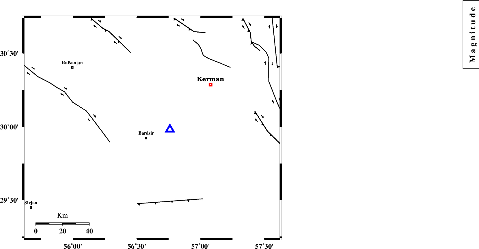
| Location | Lat:29.99 Lon: 56.62 |
| Region | Kerman Province, 9 km Bardsir |
Nearest Cities |
|
| 9 km North of Bardsir, Kerman Province | |
| 11 km North of Dashtkar, Kerman Province | |
| 21 km North East of Mahutak, Kerman Province | |
| 23 km North West of Negar, Kerman Province | |
| 28 km South West of Baghin, Kerman Province | |
| Depth | 14 km |
| Agency | |
Faults within 150 km: |
|
| RAFSANJAN_F (Length: 129 km) , Distance to epicenter: 33 km | |
| LALEHZAR_F (Length: 52 km) , Distance to epicenter: 58 km | |
| DARIVAN_F (Length: 131 km) , Distance to epicenter: 60 km | |
| Number of Phases | 6 |
| RMS | 0.1 |
| Number of Stations | 5 |
| Error in Latitude | >1.3 km |
| Error in Longitude | 2.1 km |
| Error in Depth | 2.2 km |
Download waveform in seisan format
to download seisan software Click here
to access information about IIEES stations Click here
Amplitude | ||||||||
| UID | Agency | Station | Component | Amplitude | Period | Arrival Time | Proccessing Time | Signal Clip |
| 86151 | IIEES | YZKH | N | 71 | 0.32 | 2012-09-16 15:28:10 | 2012-09-16 03:55:00 | n |
Phase | ||||||||||||
| Agency | Station | Component | Phase Type | Phase Quality | First Motion | Observed Arrival Time | Time Residual | Loc. Flag | Input Weight | Distance | Azimuth | |
| IIEES | KRBR | Z | Pg | E | 2012-09-16 15:26:38 | -0.01 | y | 14 | 95 | |||
| IIEES | BNDS | Z | Pn | E | 2012-09-16 15:27:18 | -0.02 | y | 291 | 189 | |||
| IIEES | TABS | Z | Pn | E | 2012-09-16 15:27:33 | -0.08 | y | 408 | 7 | |||
| IIEES | TABS | N | Sg | E | 2012-09-16 15:28:29 | 0.05 | y | 408 | 7 | |||
| IIEES | NASN | Z | Pn | E | 2012-09-16 15:27:42 | 0.17 | y | 477 | 312 | |||
| IIEES | NASN | N | Sg | E | 2012-09-16 15:28:48 | -0.1 | y | 477 | 312 | |||