
Magnitude |
:3 |
| Date & Time (UTC) | 2012-03-23 05:13:08.1 |
| Date & Time (Local) | 1391/1/4 09:43:08.1 |
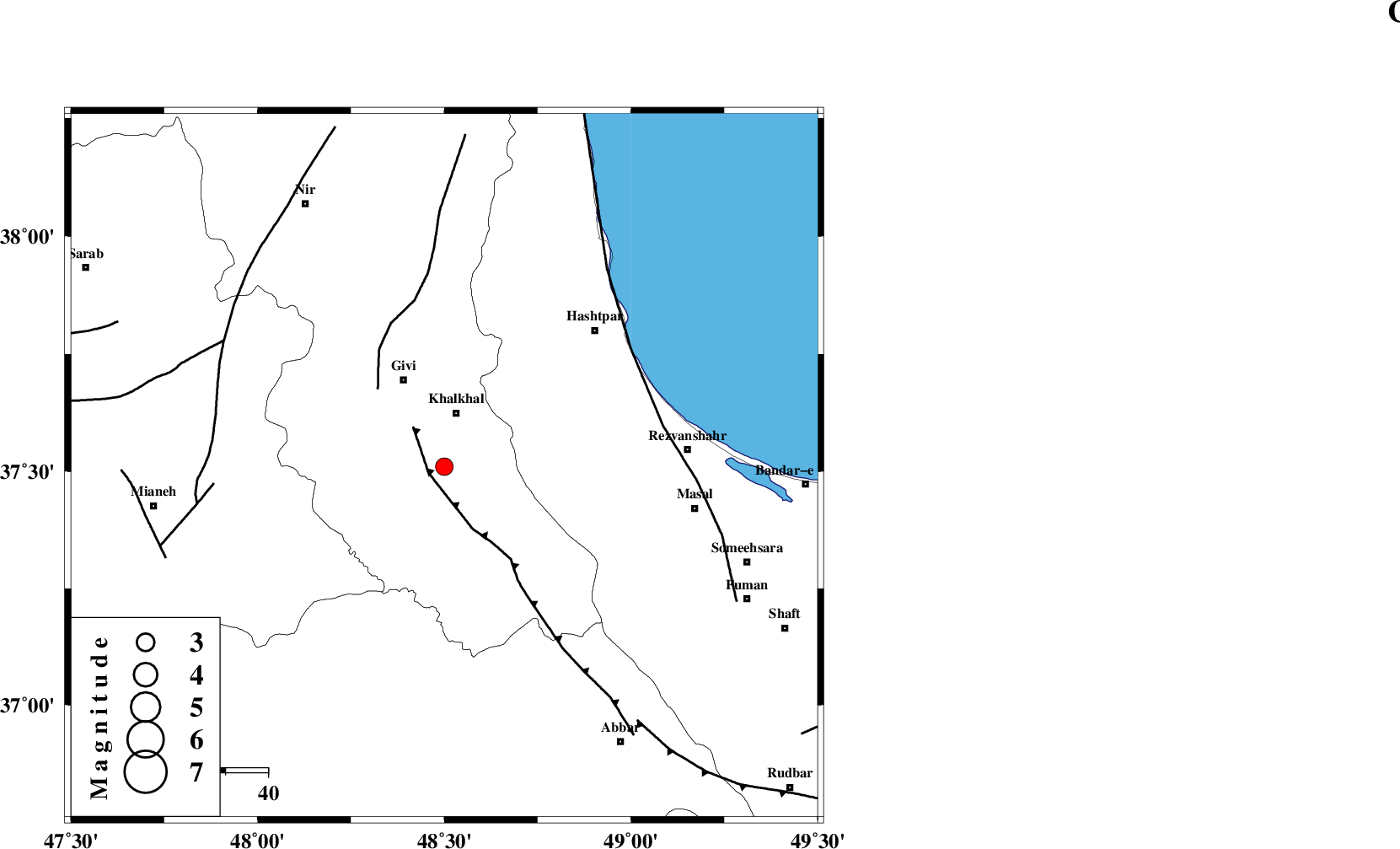
| Location | Lat:37.51 Lon: 48.5 |
| Region | Ardebil Province, 13 km South of Khalkhal |
Nearest Cities |
|
| 11 km of Khojin, Ardebil Province | |
| 12 km East of Gazaz, Ardebil Province | |
| 13 km South of Khalkhal, Ardebil Province | |
| 23 km North East of Hashtjin, Ardebil Province | |
| 23 km South East of Givi, Ardebil Province | |
| Depth | 14 km |
| Agency | |
Faults within 150 km: |
|
| MASULEL_F (Length: 90 km) , Distance to epicenter: 4 km | |
| SANGAVAR_F (Length: 61 km) , Distance to epicenter: 24 km | |
| TALESH_F (Length: 258 km) , Distance to epicenter: 52 km | |
| Number of Phases | 7 |
| RMS | 0.1 |
| Number of Stations | 5 |
| Error in Latitude | >1 km |
| Error in Longitude | 3.4 km |
| Error in Depth | 3.1 km |
Download waveform in seisan format
to download seisan software Click here
to access information about IIEES stations Click here
Amplitude | ||||||||
| UID | Agency | Station | Component | Amplitude | Period | Arrival Time | Proccessing Time | Signal Clip |
| 82493 | IIEES | THKV | N | 69.5 | 0.56 | 2012-03-23 05:14:26 | 2012-03-23 04:45:00 | n |
| 82494 | IIEES | THKV | E | 86.8 | 0.84 | 2012-03-23 05:14:29 | 2012-03-23 04:45:00 | n |
Phase | ||||||||||||
| Agency | Station | Component | Phase Type | Phase Quality | First Motion | Observed Arrival Time | Time Residual | Loc. Flag | Input Weight | Distance | Azimuth | |
| IIEES | ZNJK | Z | Pg | E | 2012-03-23 05:13:24 | -0.08 | y | 94.5 | 170 | |||
| IIEES | ZNJK | E | Sg | E | 2012-03-23 05:13:36 | -0.06 | y | 94.5 | 170 | |||
| IIEES | GRMI | Z | P | E | 2012-03-23 05:13:33 | 0 | y | 154 | 340 | |||
| IIEES | GRMI | E | Sg | E | 2012-03-23 05:13:52 | -0.03 | y | 154 | 340 | |||
| IIEES | THKV | Z | Pn | E | 2012-03-23 05:13:50 | 0.08 | y | 277 | 129 | |||
| IIEES | SNGE | Z | Pn | E | 2012-03-23 05:13:51 | 0.14 | y | 287 | 201 | |||
| IIEES | CHTH | Z | Pn | E | 2012-03-23 05:13:52 | -0.04 | y | 294 | 126 | |||