
Magnitude |
:3.6 |
| Date & Time (UTC) | 2008-03-26 04:44:31.3 |
| Date & Time (Local) | 1387/1/7 09:14:31.3 |
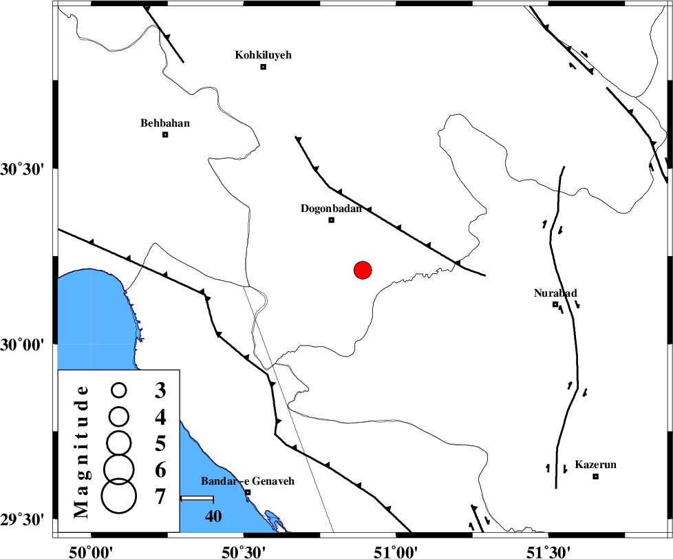
| Location | Lat:30.21 Lon: 50.89 |
| Region | 18 km South-East of Dogonbadan, Kohkiluieh va boyerahmad Province |
Nearest Cities |
|
| 19 km South East of Dogonbadan, Kohkiluieh va boyerahmad Province | |
| 31 km South West of Abdehgah, Kohkiluieh va boyerahmad Province | |
| 31 km South West of Basht, Kohkiluieh va boyerahmad Province | |
| 34 km North West of Babamonir, Fars Province | |
| 42 km South West of Kopon olia, Fars Province | |
| Depth | 15 km |
| Agency | |
Faults within 150 km: |
|
| MISHAN_F (Length: 76 km) , Distance to epicenter: 19 km | |
| ZFF3 (Length: 125 km) , Distance to epicenter: 45 km | |
| RAG_E_SEFID_F (Length: 84 km) , Distance to epicenter: 50 km | |
| Number of Phases | 5 |
| RMS | 0.2 |
| Number of Stations | 5 |
| Error in Latitude | >3.2 km |
| Error in Longitude | 2.3 km |
| Error in Depth | 0 km |
Download waveform in seisan format
to download seisan software Click here
to access information about IIEES stations Click here
Amplitude | ||||||||
| UID | Agency | Station | Component | Amplitude | Period | Arrival Time | Proccessing Time | Signal Clip |
| 48719 | IIEES | SHGR | E | 368.2 | 0.63 | 2008-03-26 04:46:04 | 2008-12-28 01:25:00 | n |
| 48720 | IIEES | SHGR | N | 266.6 | 0.6 | 2008-03-26 04:46:06 | 2008-12-28 01:25:00 | n |
| 48721 | IIEES | ASAO | N | 50.3 | 0.55 | 2008-03-26 04:46:32 | 2008-12-28 01:25:00 | n |
| 48722 | IIEES | ASAO | E | 64.7 | 0.5 | 2008-03-26 04:46:32 | 2008-12-28 01:25:00 | n |
Phase | ||||||||||||
| Agency | Station | Component | Phase Type | Phase Quality | First Motion | Observed Arrival Time | Time Residual | Loc. Flag | Input Weight | Distance | Azimuth | |
| IIEES | SHGR | Z | Pn | E | 2008-03-26 04:45:15 | 0.1 | y | 290 | 317 | |||
| IIEES | GHIR | Z | Pn | E | 2008-03-26 04:45:15 | 0 | y | 295 | 136 | |||
| IIEES | NASN | Z | Pn | E | 2008-03-26 04:45:21 | 0.1 | y | 340 | 32 | |||
| IIEES | GHVR | Z | Pn | E | 2008-03-26 04:45:37 | 0.1 | y | 475 | 4 | |||
| IIEES | ASAO | Z | Pn | E | 2008-03-26 04:45:39 | -0.3 | y | 488 | 351 | |||