
Magnitude |
:2.5 |
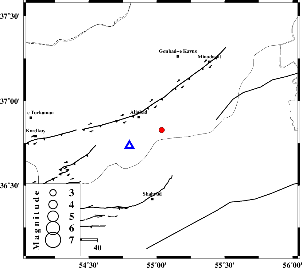
| Date & Time (UTC) | 2015-08-17 20:50:33.5 |
| Date & Time (Local) | 1394/5/27 01:20:33.5 |
| Location | Lat:36.829 Lon: 55.037 |
| Region | Golestan Province, 17 km -East of Ali Abad |
Nearest Cities |
|
| 17 km East of Ali Abad, Golestan Province | |
| 21 km South of Khanbebin, Golestan Province | |
| 22 km North of Qaleh-ye nokharqan, Semnan Province | |
| 23 km South West of Ramian, Golestan Province | |
| 23 km South of Deland, Golestan Province | |
| Depth | 14 km |
| Agency | |
Faults within 150 km: |
|
| SHAVAR_F (Length: 87 km) , Distance to epicenter: 13 km | |
| KHAZAR_F (Length: 523 km) , Distance to epicenter: 21 km | |
| ROBATE_QARABIL_F (Length: 168 km) , Distance to epicenter: 36 km | |
| Number of Phases | 7 |
| RMS | 0.2 |
| Number of Stations | 5 |
| Error in Latitude | >1.8 km |
| Error in Longitude | 8.7 km |
| Error in Depth | 6.9 km |
Download waveform in seisan format
to download seisan software Click here
to access information about IIEES stations Click here
Amplitude | ||||||||
| UID | Agency | Station | Component | Amplitude | Period | Arrival Time | Proccessing Time | Signal Clip |
| 100387 | IIEES | SHRO | E | 124.6 | 0.31 | 2015-08-17 20:51:12 | 2015-08-18 09:42:00 | n |
| 100388 | IIEES | SHRO | N | 115.2 | 0.27 | 2015-08-17 20:51:13 | 2015-08-18 09:42:00 | n |
| 100389 | IIEES | MRVT | E | 58.3 | 0.23 | 2015-08-17 20:51:14 | 2015-08-18 09:42:00 | n |
Phase | ||||||||||||
| Agency | Station | Component | Phase Type | Phase Quality | First Motion | Observed Arrival Time | Time Residual | Loc. Flag | Input Weight | Distance | Azimuth | |
| IIEES | SHRO | Z | Pg | E | 2015-08-17 20:50:54 | -0.42 | y | 126 | 136 | |||
| IIEES | SHRO | E | Sg | E | 2015-08-17 20:51:10 | 0.15 | y | 126 | 136 | |||
| IIEES | MRVT | Z | Pg | E | 2015-08-17 20:50:55 | -0.17 | y | 131 | 45 | |||
| IIEES | MRVT | N | Sg | E | 2015-08-17 20:51:11 | 0.01 | y | 131 | 45 | |||
| IIEES | BJRD | Z | Pn | E | 2015-08-17 20:51:10 | 0.29 | y | 231 | 65 | |||
| IIEES | TABS | Z | Pn | E | 2015-08-17 20:51:31 | 0.16 | y | 400 | 151 | |||
| IIEES | BSRN | Z | Pn | E | 2015-08-17 20:52:02 | 0.01 | y | 657 | 144 | |||