
| Prel. Rep. | Date | Time(UTC) | Time(Local) | Lat. | Lon. | Depth | Mag. | Region | Waveform |
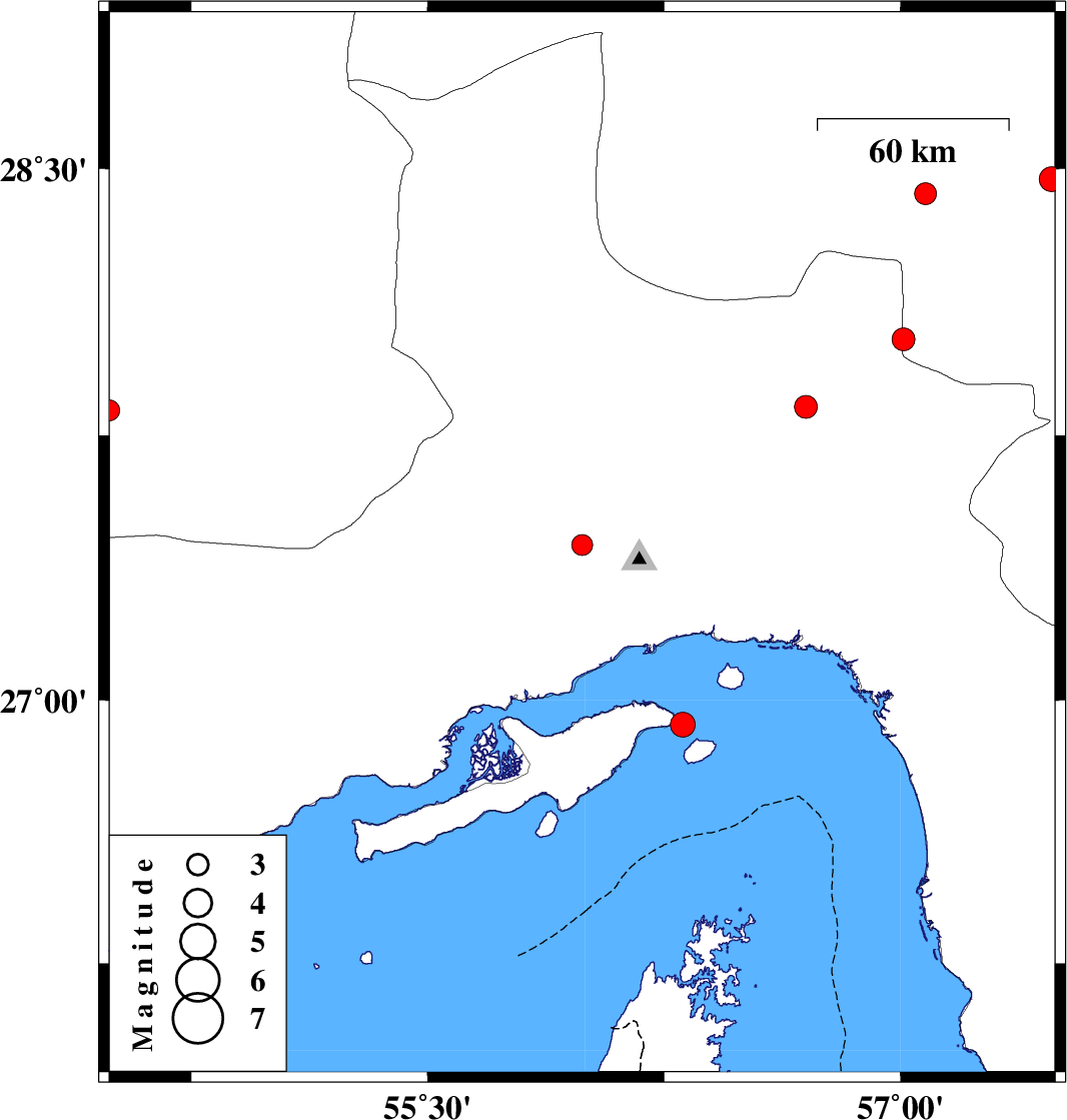
| 2010/07/17 | 08:03:40.4 | 12:33:40.4 | 27.44 | 55.99 | 18 | ML:3 | Hormozgan Province, 40 km North-West of Bandar-e abbas | ||
| 2010/07/14 | 14:12:49.4 | 18:42:49.4 | 26.93 | 56.31 | 8 | ML:3.5 | Persian Gulf, 5 km Qeshm | ||
| 2010/07/11 | 05:25:47.8 | 09:55:47.8 | 28.47 | 57.48 | 14 | ML:3.5 | Kerman Province, 34 km South-West of Jiroft | ||
| 2010/07/08 | 10:29:41.8 | 14:59:41.8 | 28.02 | 57.01 | 14 | ML:3.2 | Kerman Province, 68 km West of Kahnuj | ||
| 2010/06/30 | 04:13:59.7 | 08:43:59.7 | 27.83 | 56.7 | 14 | ML:3.3 | Hormozgan Province, 70 km North-West of Dehbarez | ||
| 2010/06/24 | 22:54:34.1 | 03:24:34.1 | 28.43 | 57.08 | 30 | ML:3.1 | Kerman Province, 70 km South-West of Jiroft | ||
| 2010/06/22 | 01:20:40.6 | 05:50:40.6 | 27.82 | 54.49 | 17 | ML:3 | Fars Province, 22 km North-East of Lar | ||
| 2010/06/17 | 13:40:17.0 | 18:10:17.0 | 26.51 | 54.7 | 14 | ML:3.5 | Hormozgan Province, 15 km West of Bandar-e lengeh | ||
| 2010/06/17 | 13:05:28.3 | 17:35:28.3 | 26.46 | 54.67 | 15 | ML:3.4 | Persian Gulf, 20 km West of Bandar-e lengeh |