| Prel. Rep. | Date | Time(UTC) | Time(Local) | Lat. | Lon. | Depth | Mag. | Region | Waveform |
|
|
2025/10/20
|
12:00:20.3
|
15:30:20.3
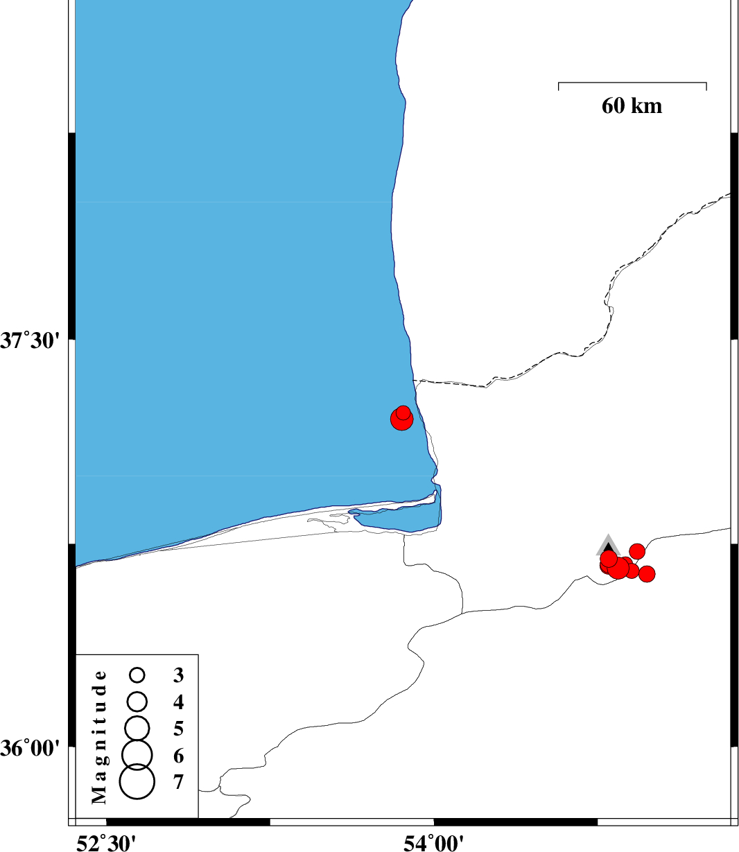
| 36.696 | 54.801 | 9 |
ML:3.5
|
Golestan Province, 24 km South of Ali Abad | |
|
|
2025/10/20
|
11:55:44.5
|
15:25:44.5
| 36.661 | 54.843 | 12 |
ML:4.5
|
Golestan Province, 27 km South of Ali Abad | |
|
|
2025/10/20
|
10:24:16.5
|
13:54:16.5
| 36.651 | 54.905 | 12 |
ML:3.1
|
Semnan Province, 28 km South of Ali Abad | |
|
|
2025/10/20
|
02:48:26.5
|
06:18:26.5
| 37.232 | 53.859 | 12 |
ML:3
|
Caspian Sea, 41 km North-West of Bandar-e torkaman | |
|
|
2025/10/18
|
03:32:30.8
|
07:02:30.8
| 36.675 | 54.801 | 12 |
ML:3.5
|
Golestan Province, 26 km South of Ali Abad | |
|
|
2025/10/16
|
23:00:58.2
|
02:30:58.2
| 36.662 | 54.86 | 12 |
ML:3
|
Golestan Province, 27 km South of Ali Abad | |
|
|
2025/10/06
|
07:46:15.0
|
11:16:15.0
| 36.671 | 54.801 | 12 |
ML:3.7
|
Golestan Province, 27 km South of Ali Abad | |
|
|
2025/10/04
|
20:59:32.4
|
00:29:32.4
| 36.723 | 54.93 | 12 |
ML:3.2
|
Golestan Province, 21 km South of Ali Abad | |
|
|
2025/09/27
|
20:49:40.1
|
00:19:40.1
| 36.639 | 54.975 | 12 |
ML:3.4
|
Semnan Province, 24 km North of Shahrud | |
|
|
2025/09/27
|
12:04:46.0
|
15:34:46.0
| 37.209 | 53.853 | 14 |
ML:4.7
|
Caspian Sea, 39 km North-West of Bandar-e torkaman | |
|
|
2025/09/26
|
16:49:44.3
|
20:19:44.3
| 36.676 | 54.877 | 10 |
ML:3
|
Golestan Province, 25 km South of Ali Abad | |
