
| Prel. Rep. | Date | Time(UTC) | Time(Local) | Lat. | Lon. | Depth | Mag. | Region | Waveform |
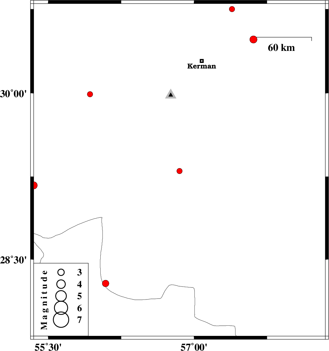
| 2019/12/11 | 08:53:21.6 | 12:23:21.6 | 29.3 | 56.85 | 19 | ML:2.5 | Kerman Province, 25 km -East of Baft | ||
| 2019/12/10 | 11:19:23.5 | 14:49:23.5 | 29.17 | 55.35 | 14 | ML:3.4 | Kerman Province, 44 km South-West of Sirjan | ||
| 2019/12/10 | 10:01:21.1 | 13:31:21.1 | 29.99 | 55.93 | 19 | ML:2.5 | Kerman Province, 46 km South of Rafsanjan | ||
| 2019/12/09 | 17:51:48.7 | 21:21:48.7 | 30.75 | 57.39 | 12 | ML:2.6 | Kerman Province, 59 km North-East of Kerman | ||
| 2019/12/06 | 19:13:36.5 | 22:43:36.5 | 30.48 | 57.61 | 10 | ML:3.4 | Kerman Province, 55 km North-East of Kerman | ||
| 2019/12/04 | 07:15:37.9 | 10:45:37.9 | 28.28 | 56.09 | 10 | ML:3.1 | Kerman Province, 19 km -East of Hajiabad |