
Magnitude |
:2.5 |
| Date & Time (UTC) | 2019-12-11 08:53:21.6 |
| Date & Time (Local) | 1398/9/20 12:23:21.6 |
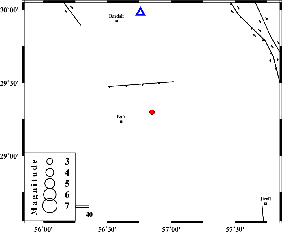
| Location | Lat:29.3 Lon: 56.85 |
| Region | Kerman Province, 25 km -East of Baft |
Nearest Cities |
|
| 2 km of Askar, Kerman Province | |
| 6 km North of Rabar, Kerman Province | |
| 8 km of Siyah bonueyeh, Kerman Province | |
| 14 km North West of Kahnuj, Kerman Province | |
| 16 km North East of Bezanjan, Kerman Province | |
| Depth | 19 km |
| Agency | |
Faults within 150 km: |
|
| LALEHZAR_F (Length: 52 km) , Distance to epicenter: 28 km | |
| RAFSANJAN_F (Length: 129 km) , Distance to epicenter: 85 km | |
| GOWK_F (Length: 152 km) , Distance to epicenter: 99 km | |
| Number of Phases | 5 |
| RMS | 0.2 |
| Number of Stations | 5 |
| Error in Latitude | >5 km |
| Error in Longitude | 0 km |
| Error in Depth | 10 km |
Download waveform in seisan format
to download seisan software Click here
to access information about IIEES stations Click here
Amplitude | ||||||||
| UID | Agency | Station | Component | Amplitude | Period | Arrival Time | Proccessing Time | Signal Clip |
| 149635 | IIEES SC | KRBR | Z | 190 | 1 | 2019-12-11 08:53:46 | 2019-12-14 08:45:00 | n |
| 149636 | IIEES SC | BNDS | Z | 14 | 1 | 2019-12-11 08:54:14 | 2019-12-14 08:45:00 | n |
| 149637 | IIEES SC | BSRN | Z | 5.6 | 1 | 2019-12-11 08:55:14 | 2019-12-14 08:45:00 | n |
Phase | ||||||||||||
| Agency | Station | Component | Phase Type | Phase Quality | First Motion | Observed Arrival Time | Time Residual | Loc. Flag | Input Weight | Distance | Azimuth | |
| IIEES SC | KRBR | N | IS | I | 2019-12-11 08:53:44 | -0.2 | y | 77 | 353 | |||
| IIEES SC | KRBR | Z | IP | I | 2019-12-11 08:53:35 | 0.4 | y | 77 | 353 | |||
| IIEES SC | BNDS | N | IS | I | 2019-12-11 08:54:22 | 0.1 | y | 222 | 198 | |||
| IIEES SC | BNDS | Z | IP | I | 2019-12-11 08:53:56 | -0.2 | y | 222 | 198 | |||
| IIEES SC | BSRN | Z | IP | I | 2019-12-11 08:54:14 | 0 | y | 366 | 36 | |||