
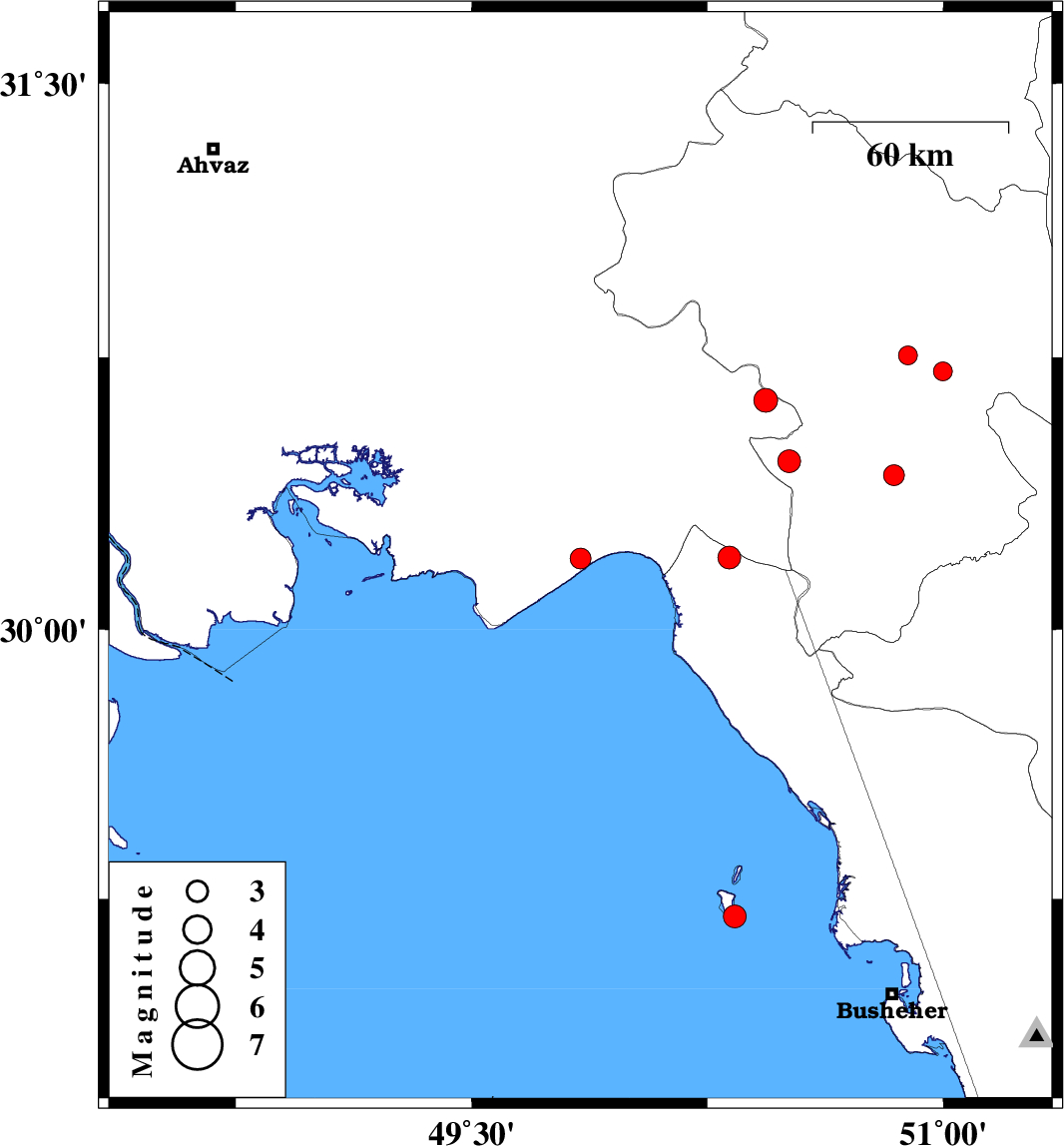
| Prel. Rep. | Date | Time(UTC) | Time(Local) | Lat. | Lon. | Depth | Mag. | Region | Waveform |
| 2016/05/22 | 07:32:22.2 | 12:02:22.2 | 29.202 | 50.336 | 6 | ML:3.2 | Persian Gulf, 45 km South-West of Bandar-e genaveh | ||
| 2016/05/22 | 00:08:15.6 | 04:38:15.6 | 30.195 | 49.846 | 18 | ML:3 | Khoozestan Province, 14 km -East of Hendijan | ||
| 2016/05/17 | 19:33:04.1 | 00:03:04.1 | 30.632 | 50.435 | 15 | ML:3.4 | Khoozestan Province, 19 km -East of Behbahan | ||
| 2016/05/14 | 19:21:02.6 | 23:51:02.6 | 30.755 | 50.888 | 18 | ML:2.7 | Kohkiluieh va boyerahmad Province, 31 km -East of Dehdasht | ||
| 2016/05/11 | 05:24:36.3 | 09:54:36.3 | 30.198 | 50.32 | 15 | ML:3.2 | Khoozestan Province, 45 km South of Behbahan | ||
| 2016/05/08 | 09:38:09.0 | 14:08:09.0 | 30.711 | 50.998 | 14 | ML:2.7 | Kohkiluieh va boyerahmad Province, 42 km -East of Dehdasht | ||
| 2016/04/29 | 19:54:09.4 | 00:24:09.4 | 30.464 | 50.509 | 14 | ML:3.2 | Kohkiluieh va boyerahmad Province, 36 km South of Dehdasht | ||
| 2016/04/29 | 10:28:28.5 | 14:58:28.5 | 30.426 | 50.843 | 15 | ML:3 | Kohkiluieh va boyerahmad Province, 10 km of Dogonbadan |