
Magnitude |
:3.5 |
| Date & Time (UTC) | 2006-09-22 17:45:03.4 |
| Date & Time (Local) | 1385/6/31 21:15:03.4 |
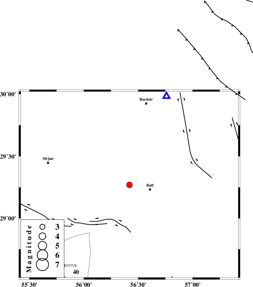
| Location | Lat:29.27 Lon: 56.42 |
| Region | 19 km West of Baft, Kerman Province |
Nearest Cities |
|
| 19 km North West of Baft, Kerman Province | |
| 21 km South of Amirabad, Kerman Province | |
| 22 km West of Karin, Kerman Province | |
| 27 km North West of Bezanjan, Kerman Province | |
| 37 km South West of Ghale-ye asgar, Kerman Province | |
| Depth | 15 km |
| Agency | |
Faults within 150 km: |
|
| LALEHZAR_F (Length: 52 km) , Distance to epicenter: 24 km | |
| RAFSANJAN_F (Length: 129 km) , Distance to epicenter: 70 km | |
| SHAHR_E_BABAK_F2 (Length: 272 km) , Distance to epicenter: 107 km | |
| Number of Phases | 5 |
| RMS | 0.2 |
| Number of Stations | 3 |
| Error in Latitude | >2.1 km |
| Error in Longitude | 7.9 km |
| Error in Depth | 8.1 km |
Download waveform in seisan format
to download seisan software Click here
to access information about IIEES stations Click here
Amplitude | ||||||||
| UID | Agency | Station | Component | Amplitude | Period | Arrival Time | Proccessing Time | Signal Clip |
| 35954 | IIEES | BNDS | E | 340.1 | 0.48 | 2006-09-22 17:46:03 | 2006-10-17 03:59:00 | n |
| 35955 | IIEES | BNDS | N | 402.7 | 0.6 | 2006-09-22 17:46:05 | 2006-10-17 03:59:00 | n |
| 35956 | IIEES | GHIR | E | 184.1 | 0.28 | 2006-09-22 17:46:37 | 2006-10-17 03:59:00 | n |
Phase | ||||||||||||
| Agency | Station | Component | Phase Type | Phase Quality | First Motion | Observed Arrival Time | Time Residual | Loc. Flag | Input Weight | Distance | Azimuth | |
| IIEES | KRBR | Z | Pg | E | 2006-09-22 17:45:18 | -0.3 | y | 85.8 | 23 | |||
| IIEES | KRBR | N | Sg | E | 2006-09-22 17:45:29 | 0.2 | y | 85.8 | 23 | |||
| IIEES | BNDS | Z | Pn | E | 2006-09-22 17:45:37 | 0 | y | 209 | 187 | |||
| IIEES | BNDS | N | Sg | E | 2006-09-22 17:46:02 | 0.1 | y | 209 | 187 | |||
| IIEES | GHIR | Z | Pn | E | 2006-09-22 17:45:54 | 0 | y | 352 | 253 | |||