| Prel. Rep. | Date | Time(UTC) | Time(Local) | Lat. | Lon. | Depth | Mag. | Region | Waveform |
|
|
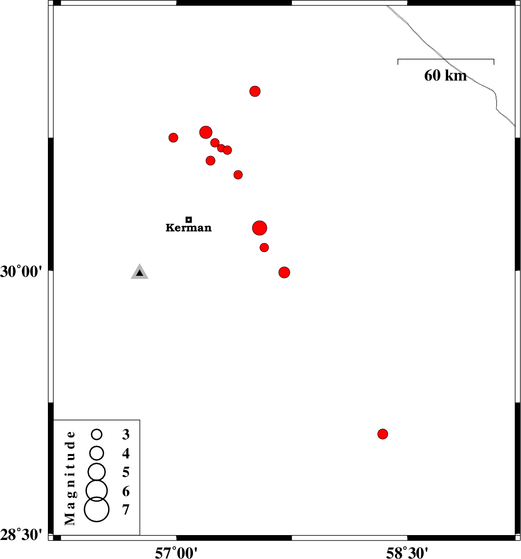
2014/09/30
|
22:44:00.3
|
02:14:00.3
| 29.99 | 57.7 | 17 |
ML:3.3
|
Kerman Province, 69 km South-East of Kerman | |
|
|
2014/09/29
|
19:23:03.5
|
22:53:03.5
| 29.07 | 58.34 | 14 |
ML:3
|
Kerman Province, 5 km Bam | |
|
|
2014/09/26
|
22:13:16.9
|
01:43:16.9
| 30.68 | 57.33 | 14 |
ML:2.6
|
Kerman Province, 50 km North-East of Kerman | |
|
|
2014/09/25
|
21:21:56.2
|
00:51:56.2
| 30.72 | 57.25 | 14 |
ML:2.6
|
Kerman Province, 50 km North-East of Kerman | |
|
|
2014/09/24
|
05:01:34.1
|
08:31:34.1
| 30.69 | 57.29 | 15 |
ML:2.2
|
Kerman Province, 49 km North-East of Kerman | |
|
|
2014/09/24
|
03:17:13.2
|
06:47:13.2
| 30.62 | 57.22 | 14 |
ML:2.7
|
Kerman Province, 39 km North-East of Kerman | |
|
|
2014/09/23
|
01:22:35.9
|
04:52:35.9
| 30.54 | 57.4 | 18 |
ML:2.6
|
Kerman Province, 41 km North-East of Kerman | |
|
|
2014/09/22
|
06:26:05.9
|
09:56:05.9
| 30.78 | 57.19 | 14 |
ML:3.7
|
Kerman Province, 55 km North-East of Kerman | |
|
|
2014/09/20
|
09:09:23.0
|
13:39:23.0
| 31.01 | 57.51 | 14 |
ML:3.1
|
Kerman Province, 72 km South-East of Ravar | |
|
|
2014/09/16
|
19:38:56.8
|
00:08:56.8
| 30.13 | 57.57 | 16 |
ML:2.6
|
Kerman Province, 51 km South-East of Kerman | |
|
|
2014/09/16
|
17:25:28.4
|
21:55:28.4
| 30.24 | 57.54 | 14 |
ML:4.2
|
Kerman Province, 44 km East of Kerman | |
|
|
2014/09/09
|
04:40:38.1
|
09:10:38.1
| 30.75 | 56.98 | 18 |
ML:2.7
|
Kerman Province, 40 km East of Zarand | |
