| Prel. Rep. | Date | Time(UTC) | Time(Local) | Lat. | Lon. | Depth | Mag. | Region | Waveform |
|
|
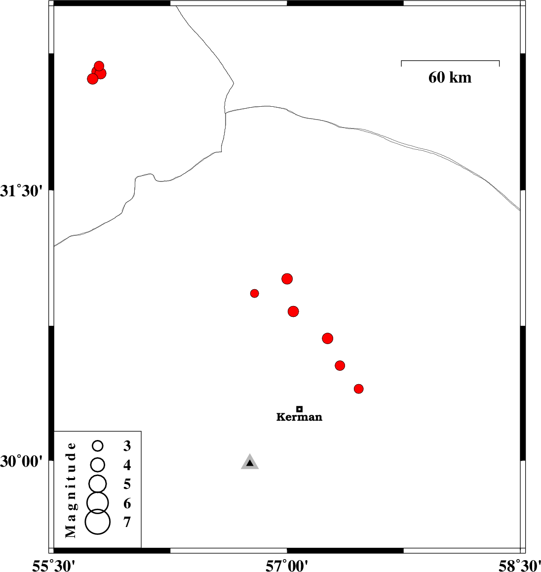
2014/07/29
|
17:55:02.9
|
22:25:02.9
| 31.01 | 57 | 15 |
ML:3.1
|
Kerman Province, 34 km South-East of Ravar | |
|
|
2014/07/28
|
20:25:33.2
|
00:55:33.2
| 32.11 | 55.75 | 18 |
ML:3.1
|
Yazd Province, 65 km North-East of Bafq | |
|
|
2014/07/28
|
13:02:15.4
|
17:32:15.4
| 30.68 | 57.26 | 14 |
ML:3.1
|
Kerman Province, 47 km North-East of Kerman | |
|
|
2014/07/28
|
11:36:42.1
|
16:06:42.1
| 30.93 | 56.79 | 18 |
ML:2.4
|
Kerman Province, 25 km North-East of Zarand | |
|
|
2014/07/27
|
00:04:14.9
|
04:34:14.9
| 30.83 | 57.04 | 14 |
ML:3.1
|
Kerman Province, 45 km East of Zarand | |
|
|
2014/07/14
|
21:50:32.8
|
02:20:32.8
| 30.53 | 57.34 | 14 |
ML:2.8
|
Kerman Province, 37 km North-East of Kerman | |
|
|
2014/07/07
|
18:39:54.9
|
23:09:54.9
| 30.4 | 57.46 | 14 |
ML:2.7
|
Kerman Province, 38 km North-East of Kerman | |
|
|
2014/07/06
|
03:29:31.7
|
07:59:31.7
| 32.18 | 55.79 | 18 |
ML:2.8
|
Yazd Province, 74 km North-East of Bafq | |
|
|
2014/07/06
|
03:22:13.5
|
07:52:13.5
| 32.14 | 55.8 | 14 |
ML:3.2
|
Yazd Province, 71 km North-East of Bafq | |
|
|
2014/07/05
|
22:14:08.2
|
02:44:08.2
| 32.15 | 55.78 | 17 |
ML:3.2
|
Yazd Province, 71 km North-East of Bafq | |
