
| Prel. Rep. | Date | Time(UTC) | Time(Local) | Lat. | Lon. | Depth | Mag. | Region | Waveform |
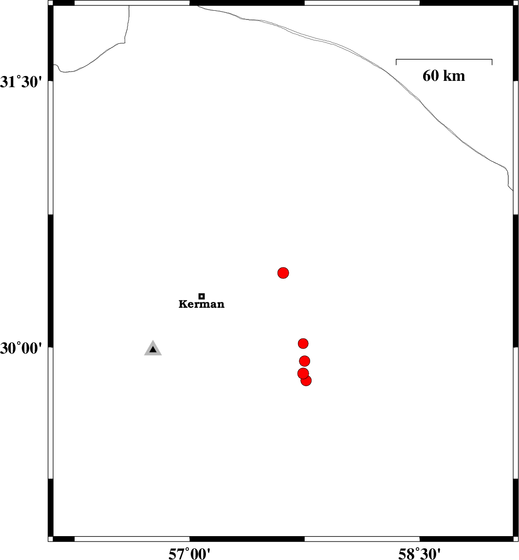
| 2014/02/24 | 03:10:30.9 | 06:40:30.9 | 30.42 | 57.61 | 18 | ML:3.2 | Kerman Province, 53 km North-East of Kerman | ||
| 2014/02/22 | 19:12:00.1 | 22:42:00.1 | 30.02 | 57.74 | 14 | ML:2.9 | Kerman Province, 70 km South-East of Kerman | ||
| 2014/02/21 | 22:57:01.7 | 02:27:01.7 | 29.92 | 57.75 | 35 | ML:3.1 | Kerman Province, 76 km South-East of Kerman | ||
| 2014/02/21 | 11:14:59.6 | 14:44:59.6 | 29.85 | 57.74 | 42 | ML:3.2 | Kerman Province, 80 km South-East of Kerman | ||
| 2014/02/21 | 10:57:27.4 | 14:27:27.4 | 29.81 | 57.76 | 42 | ML:3.1 | Kerman Province, 127 km North of Jiroft |