| Prel. Rep. | Date | Time(UTC) | Time(Local) | Lat. | Lon. | Depth | Mag. | Region | Waveform |
|
|
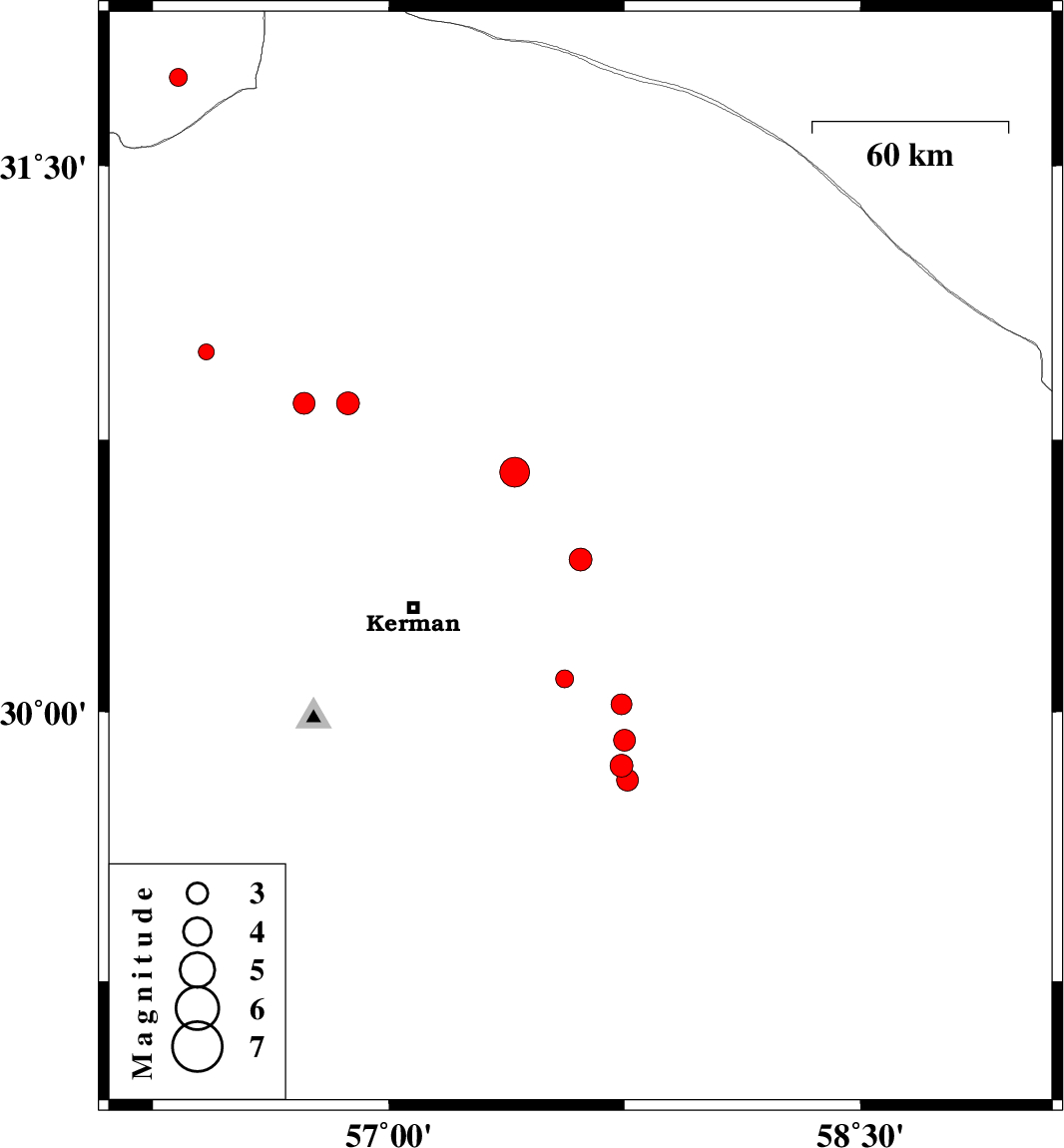
2014/02/24
|
03:10:30.9
|
06:40:30.9
| 30.42 | 57.61 | 18 |
ML:3.2
|
Kerman Province, 53 km North-East of Kerman | |
|
|
2014/02/22
|
19:12:00.1
|
22:42:00.1
| 30.02 | 57.74 | 14 |
ML:2.9
|
Kerman Province, 70 km South-East of Kerman | |
|
|
2014/02/21
|
22:57:01.7
|
02:27:01.7
| 29.92 | 57.75 | 35 |
ML:3.1
|
Kerman Province, 76 km South-East of Kerman | |
|
|
2014/02/21
|
11:14:59.6
|
14:44:59.6
| 29.85 | 57.74 | 42 |
ML:3.2
|
Kerman Province, 80 km South-East of Kerman | |
|
|
2014/02/21
|
10:57:27.4
|
14:27:27.4
| 29.81 | 57.76 | 42 |
ML:3.1
|
Kerman Province, 127 km North of Jiroft | |
|
|
2014/02/15
|
18:57:22.6
|
22:27:22.6
| 30.66 | 57.4 | 14 |
ML:4.2
|
Kerman Province, 51 km North-East of Kerman | |
|
|
2014/02/14
|
21:23:40.8
|
00:53:40.8
| 30.85 | 56.87 | 14 |
ML:3.3
|
Kerman Province, 29 km East of Zarand | |
|
|
2014/02/02
|
08:15:24.7
|
11:45:24.7
| 30.85 | 56.73 | 14 |
ML:3.1
|
Kerman Province, 16 km East of Zarand | |
|
|
2014/01/31
|
23:57:53.7
|
03:27:53.7
| 30.09 | 57.56 | 14 |
ML:2.5
|
Kerman Province, 51 km South-East of Kerman | |
|
|
2014/01/30
|
13:23:54.4
|
16:53:54.4
| 30.99 | 56.42 | 14 |
ML:2.3
|
Kerman Province, 25 km North-West of Zarand | |
|
|
2014/01/30
|
12:51:55.2
|
16:21:55.2
| 31.74 | 56.33 | 14 |
ML:2.5
|
Yazd Province, 70 km North-West of Ravar | |
