
| Prel. Rep. | Date | Time(UTC) | Time(Local) | Lat. | Lon. | Depth | Mag. | Region | Waveform |
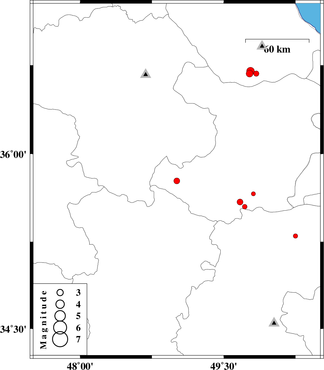
| 2013/01/04 | 16:10:08.2 | 19:40:08.2 | 36.68 | 49.84 | 14 | ML:2.5 | Gilan Province, 52 km South of Siahkal | ||
| 2013/01/04 | 07:48:10.8 | 11:18:10.8 | 35.77 | 49.01 | 14 | ML:2.8 | Ghazvin Province, 43 km North of Razan | ||
| 2013/01/04 | 06:32:23.2 | 10:02:23.2 | 35.77 | 49.01 | 15 | ML:2.2 | Ghazvin Province, 43 km North of Razan | ||
| 2012/12/27 | 16:31:40.3 | 20:01:40.3 | 35.66 | 49.81 | 31 | ML:2 | Ghazvin Province, 27 km South-West of Buinzara | ||
| 2012/12/18 | 22:30:55.0 | 02:00:55.0 | 36.68 | 49.77 | 15 | ML:3.3 | Gilan Province, 34 km South-East of Rudbar | ||
| 2012/12/18 | 04:35:50.3 | 08:05:50.3 | 35.55 | 49.72 | 15 | ML:2.2 | Ghazvin Province, 57 km South of Takestan | ||
| 2012/12/15 | 07:46:43.5 | 11:16:43.5 | 36.7 | 49.78 | 14 | ML:3.6 | Gilan Province, 35 km South-East of Rudbar | ||
| 2012/12/13 | 12:16:30.6 | 15:46:30.6 | 35.3 | 50.25 | 32 | ML:2.1 | Markazi Province, 32 km North-West of Saveh | ||
| 2012/12/09 | 01:36:11.5 | 05:06:11.5 | 35.59 | 49.67 | 18 | ML:2.8 | Ghazvin Province, 53 km South of Takestan |