
| Prel. Rep. | Date | Time(UTC) | Time(Local) | Lat. | Lon. | Depth | Mag. | Region | Waveform |
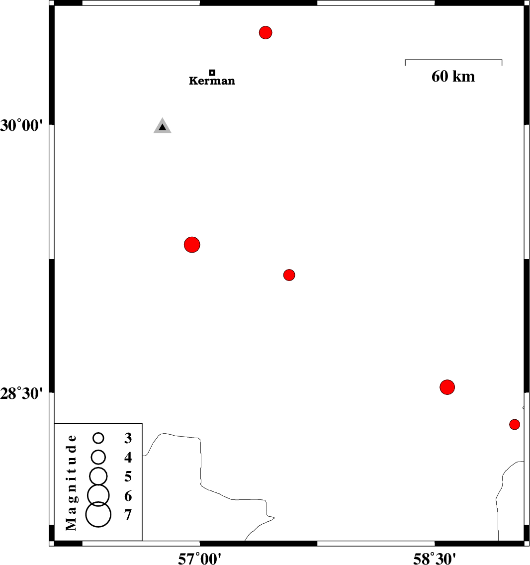
| 2012/11/26 | 09:35:52.9 | 13:05:52.9 | 29.16 | 57.57 | 18 | ML:3.2 | Kerman Province, 57 km North-West of Jiroft | ||
| 2012/11/17 | 08:46:01.1 | 12:16:01.1 | 28.32 | 59.01 | 46 | ML:3 | Kerman Province, 109 km South-East of Bam | ||
| 2012/11/14 | 00:46:13.4 | 04:16:13.4 | 30.51 | 57.42 | 16 | ML:3.6 | Kerman Province, 40 km North-East of Kerman | ||
| 2012/10/29 | 10:51:00.2 | 14:21:00.2 | 28.53 | 58.58 | 14 | ML:4.3 | Kerman Province, 68 km South-East of Bam | ||
| 2012/10/27 | 20:54:54.8 | 00:24:54.8 | 29.33 | 56.95 | 15 | ML:4.5 | Kerman Province, 35 km East of Baft |