
| Prel. Rep. | Date | Time(UTC) | Time(Local) | Lat. | Lon. | Depth | Mag. | Region | Waveform |
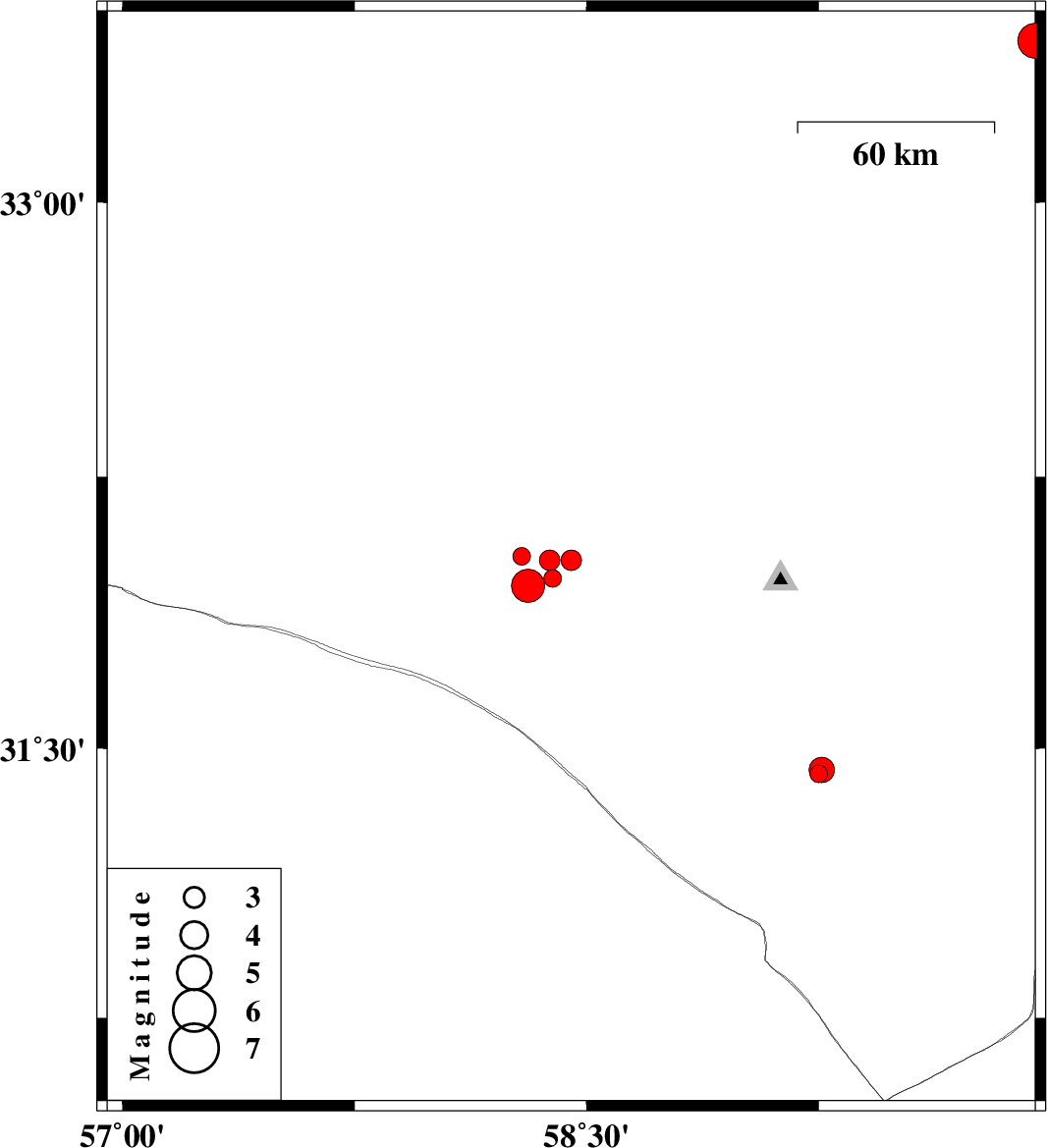
| 2012/09/21 | 03:51:18.5 | 07:21:18.5 | 32.03 | 58.29 | 14 | ML:2.6 | Khorasan(south) Province, 131 km South-West of Birjand | ||
| 2012/09/21 | 03:34:47.8 | 07:04:47.8 | 32.02 | 58.45 | 14 | ML:2.9 | Khorasan(south) Province, 122 km South-West of Birjand | ||
| 2012/09/21 | 03:28:30.0 | 06:58:30.0 | 31.95 | 58.31 | 14 | ML:4.8 | Khorasan(south) Province, 136 km South-West of Birjand | ||
| 2012/09/19 | 22:56:54.1 | 03:26:54.1 | 31.97 | 58.39 | 14 | ML:2.5 | Khorasan(south) Province, 130 km South-West of Birjand | ||
| 2012/09/17 | 11:05:03.2 | 15:35:03.2 | 32.02 | 58.38 | 14 | ML:2.9 | Khorasan(south) Province, 126 km South-West of Birjand | ||
| 2012/09/10 | 20:19:59.5 | 00:49:59.5 | 31.43 | 59.25 | 14 | ML:2.5 | Khorasan(south) Province, 75 km South-West of Nehbandan | ||
| 2012/09/10 | 15:35:44.9 | 20:05:44.9 | 31.44 | 59.26 | 18 | ML:3.7 | Khorasan(south) Province, 75 km West of Nehbandan | ||
| 2012/09/08 | 06:04:59.4 | 10:34:59.4 | 30.98 | 57.33 | 18 | ML:2.9 | Kerman Province, 59 km South-East of Ravar | ||
| 2012/09/02 | 00:50:00.4 | 05:20:00.4 | 33.44 | 59.95 | 18 | ML:5.1 | Khorasan(south) Province, 92 km North-East of Sarbisheh |