| Prel. Rep. | Date | Time(UTC) | Time(Local) | Lat. | Lon. | Depth | Mag. | Region | Waveform |
|
|
2012/06/07
|
21:27:09.0
|
01:57:09.0
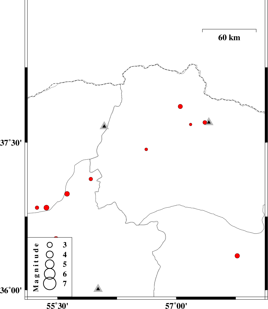
| 37.43 | 56.62 | 46 |
ML:1.7
|
Khorasan(north) Province, 31 km South-West of Ashkhaneh | |
|
|
2012/06/07
|
12:58:05.7
|
17:28:05.7
| 37.7 | 57.36 | 37 |
ML:2.2
|
Khorasan(north) Province, 26 km North of Bojnurd | |
|
|
2012/06/05
|
06:04:34.3
|
10:34:34.3
| 37.68 | 57.18 | 14 |
ML:1.6
|
Khorasan(north) Province, 26 km North-West of Bojnurd | |
|
|
2012/05/26
|
09:36:54.6
|
14:06:54.6
| 37.13 | 55.92 | 40 |
ML:2.1
|
Semnan Province, 48 km South-East of Minodasht | |
|
|
2012/05/24
|
20:39:04.8
|
01:09:04.8
| 36.98 | 55.62 | 14 |
ML:2.8
|
Semnan Province, 35 km South-East of Minodasht | |
|
|
2012/05/17
|
07:51:20.6
|
12:21:20.6
| 36.84 | 55.36 | 8 |
ML:2.9
|
Golestan Province, 27 km South-East of Ramian | |
|
|
2012/05/17
|
01:18:57.9
|
05:48:57.9
| 36.52 | 55.48 | 14 |
ML:3
|
Semnan Province, 47 km North-East of Shahrud | |
|
|
2012/05/16
|
15:15:18.0
|
19:45:18.0
| 37.86 | 57.05 | 14 |
ML:2.6
|
Khorasan(north) Province, 36 km North-East of Ashkhaneh | |
|
|
2012/05/10
|
04:21:42.5
|
08:51:42.5
| 36.84 | 55.24 | 14 |
ML:2.1
|
Golestan Province, 21 km South of Ramian | |
|
|
2012/05/09
|
01:55:56.5
|
06:25:56.5
| 36.35 | 57.77 | 14 |
ML:2.7
|
Khorasan(center) Province, 18 km North of Sabzevar | |
