
| Prel. Rep. | Date | Time(UTC) | Time(Local) | Lat. | Lon. | Depth | Mag. | Region | Waveform |
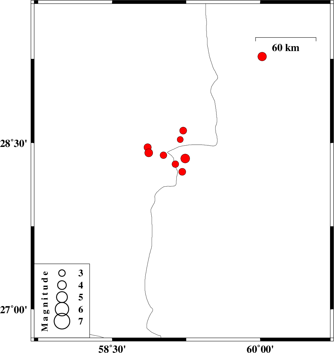
| 2011/01/06 | 02:51:35.0 | 06:21:35.0 | 28.24 | 59.21 | 14 | ML:3.3 | Sistan va Baloochestan Province, 128 km South-East of Bam | ||
| 2011/01/03 | 00:17:35.8 | 03:47:35.8 | 28.53 | 59.19 | 46 | ML:2.8 | Kerman Province, 104 km South-East of Bam | ||
| 2011/01/02 | 23:46:53.3 | 03:16:53.3 | 28.31 | 59.14 | 14 | ML:3.1 | Sistan va Baloochestan Province, 117 km South-East of Bam | ||
| 2011/01/02 | 15:33:55.5 | 19:03:55.5 | 28.61 | 59.22 | 14 | ML:3.3 | Kerman Province, 100 km South-East of Bam | ||
| 2011/01/02 | 15:23:46.1 | 18:53:46.1 | 28.36 | 59.24 | 16 | ML:4.1 | Sistan va Baloochestan Province, 120 km South-East of Bam | ||
| 2010/12/31 | 23:18:41.4 | 02:48:41.4 | 29.27 | 60.02 | 15 | ML:3.9 | Sistan va Baloochestan Province, 86 km South-West of Zahedan | ||
| 2010/12/31 | 16:02:30.4 | 19:32:30.4 | 28.41 | 58.87 | 14 | ML:3.7 | Kerman Province, 92 km South-East of Bam | ||
| 2010/12/31 | 04:32:40.5 | 08:02:40.5 | 28.39 | 59.02 | 14 | ML:3.1 | Kerman Province, 103 km South-East of Bam | ||
| 2010/12/30 | 02:43:03.0 | 06:13:03.0 | 28.46 | 58.86 | 18 | ML:3.4 | Kerman Province, 87 km South-East of Bam |