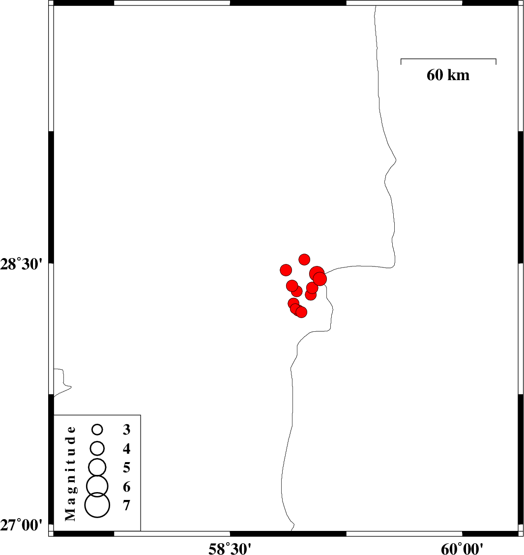
| Prel. Rep. | Date | Time(UTC) | Time(Local) | Lat. | Lon. | Depth | Mag. | Region | Waveform |
|
|
2010/12/30
|
02:43:03.0
|
06:13:03.0
| 28.46 | 58.86 | 18 |
ML:3.4
|
Kerman Province, 87 km South-East of Bam | |
|
|
2010/12/28
|
19:01:44.7
|
22:31:44.7
| 28.41 | 59.08 | 46 |
ML:4
|
Sistan va Baloochestan Province, 104 km South-East of Bam | |
|
|
2010/12/28
|
03:06:28.1
|
06:36:28.1
| 28.52 | 58.98 | 14 |
ML:3.2
|
Kerman Province, 89 km South-East of Bam | |
|
|
2010/12/25
|
22:24:16.6
|
01:54:16.6
| 28.44 | 59.06 | 44 |
ML:4.4
|
Kerman Province, 101 km South-East of Bam | |
|
|
2010/12/25
|
19:36:11.4
|
23:06:11.4
| 28.42 | 59.08 | 46 |
ML:3.3
|
Sistan va Baloochestan Province, 105 km South-East of Bam | |
|
|
2010/12/25
|
17:51:59.6
|
21:21:59.6
| 28.36 | 59.03 | 46 |
ML:3.4
|
Kerman Province, 106 km South-East of Bam | |
|
|
2010/12/25
|
09:46:05.7
|
13:16:05.7
| 28.32 | 59.02 | 18 |
ML:3.2
|
Kerman Province, 109 km South-East of Bam | |
|
|
2010/12/25
|
05:39:43.6
|
09:09:43.6
| 28.22 | 58.96 | 16 |
ML:3.2
|
Kerman Province, 115 km South-East of Bam | |
|
|
2010/12/24
|
20:46:11.2
|
00:16:11.2
| 28.24 | 58.92 | 18 |
ML:2.9
|
Kerman Province, 112 km South-East of Bam | |
|
|
2010/12/24
|
14:14:52.2
|
17:44:52.2
| 28.37 | 58.9 | 14 |
ML:3.4
|
Kerman Province, 97 km South-East of Bam | |
|
|
2010/12/23
|
20:07:55.6
|
23:37:55.6
| 28.34 | 58.93 | 14 |
ML:3.2
|
Kerman Province, 102 km South-East of Bam | |
|
|
2010/12/23
|
08:45:19.4
|
12:15:19.4
| 28.23 | 58.94 | 16 |
ML:3.3
|
Kerman Province, 113 km South-East of Bam | |
|
|
2010/12/23
|
00:33:58.6
|
04:03:58.6
| 28.27 | 58.91 | 14 |
ML:3.3
|
Kerman Province, 108 km South-East of Bam | |
