| Prel. Rep. | Date | Time(UTC) | Time(Local) | Lat. | Lon. | Depth | Mag. | Region | Waveform |
|
|
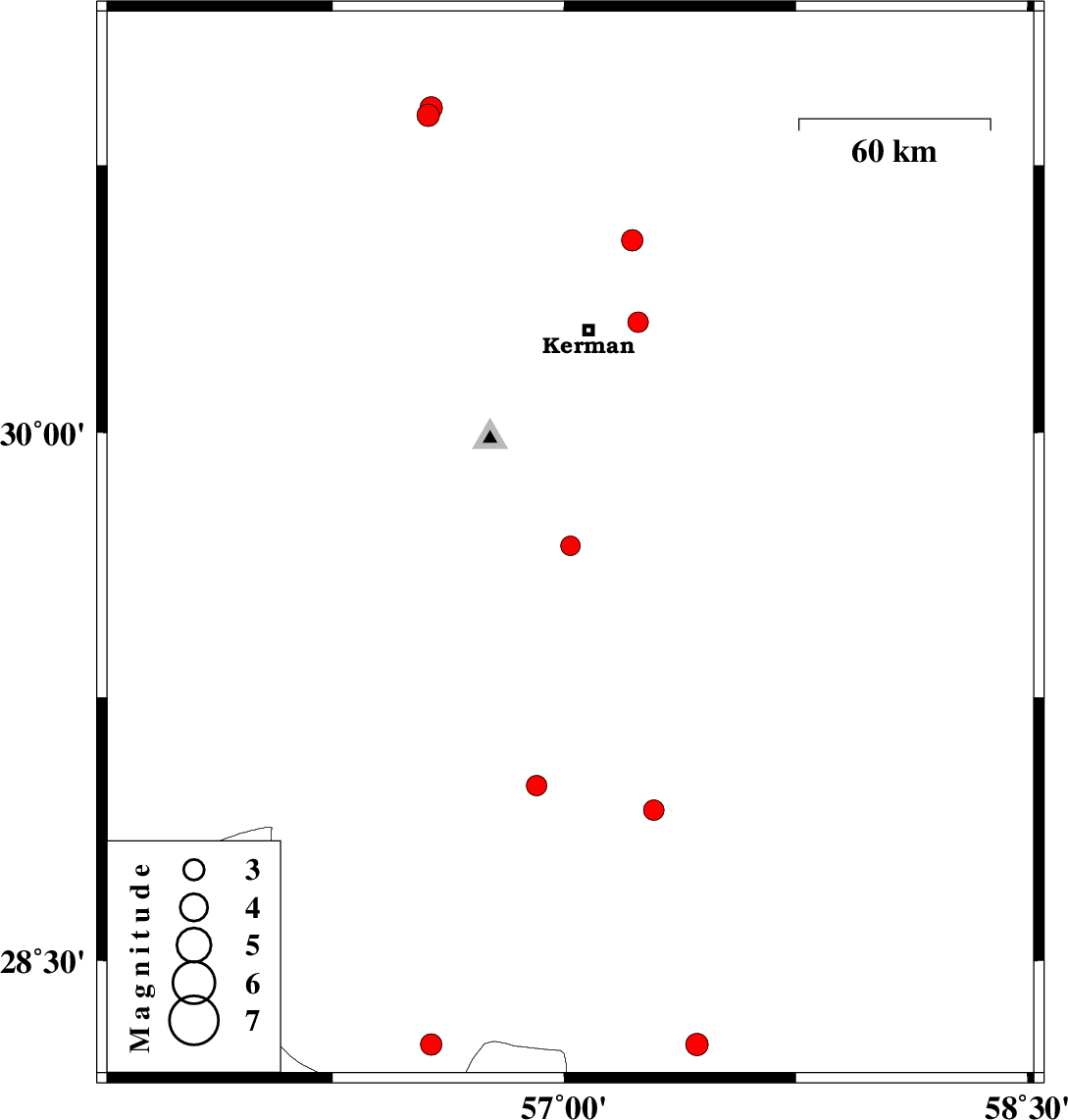
2010/11/17
|
16:53:38.7
|
20:23:38.7
| 29.68 | 57.02 | 18 |
ML:2.8
|
Kerman Province, 68 km South of Kerman | |
|
|
2010/11/17
|
10:14:02.6
|
13:44:02.6
| 30.54 | 57.22 | 15 |
ML:3.1
|
Kerman Province, 31 km North-East of Kerman | |
|
|
2010/11/08
|
11:14:57.4
|
14:44:57.4
| 28.26 | 56.57 | 14 |
ML:3.1
|
Kerman Province, 65 km East of Hajiabad | |
|
|
2010/11/04
|
18:19:15.6
|
21:49:15.6
| 29 | 56.91 | 14 |
ML:2.9
|
Kerman Province, 40 km South-East of Baft | |
|
|
2010/10/31
|
16:16:59.7
|
19:46:59.7
| 30.31 | 57.24 | 30 |
ML:3
|
Kerman Province, 16 km East of Kerman | |
|
|
2010/10/31
|
13:43:37.8
|
17:13:37.8
| 28.26 | 57.43 | 14 |
ML:3.2
|
Kerman Province, 43 km North-West of Kahnuj | |
|
|
2010/10/30
|
09:52:50.2
|
13:22:50.2
| 28.19 | 55.89 | 15 |
ML:3.4
|
Hormozgan Province, 14 km South of Hajiabad | |
|
|
2010/10/25
|
05:09:30.8
|
08:39:30.8
| 28.93 | 57.29 | 18 |
ML:2.9
|
Kerman Province, 52 km North-West of Jiroft | |
|
|
2010/10/20
|
08:44:48.0
|
12:14:48.0
| 30.89 | 56.56 | 16 |
ML:3.3
|
Kerman Province, 9 km Zarand | |
|
|
2010/10/19
|
22:25:51.8
|
01:55:51.8
| 30.91 | 56.57 | 16 |
ML:3.3
|
Kerman Province, 11 km Zarand | |