
| Prel. Rep. | Date | Time(UTC) | Time(Local) | Lat. | Lon. | Depth | Mag. | Region | Waveform |
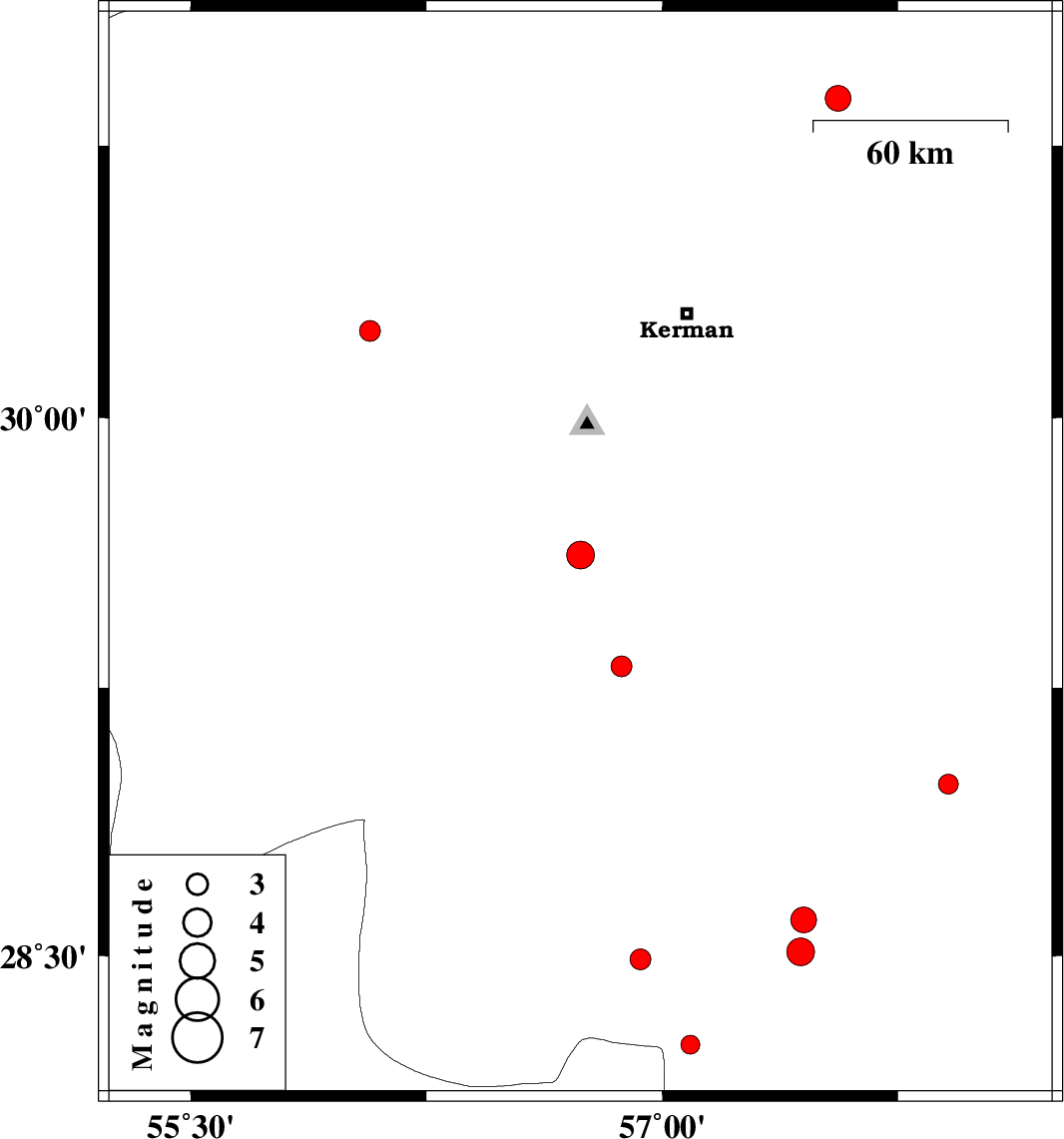
| 2010/05/14 | 11:21:23.7 | 15:51:23.7 | 29.62 | 56.74 | 5 | ML:4 | Kerman Province, 37 km South-East of Bardsir | ||
| 2010/05/07 | 19:32:30.2 | 00:02:30.2 | 30.24 | 56.07 | 18 | ML:3 | Kerman Province, 19 km South of Rafsanjan | ||
| 2010/05/07 | 17:28:23.6 | 21:58:23.6 | 29.31 | 56.87 | 14 | ML:2.9 | Kerman Province, 26 km East of Baft | ||
| 2010/05/06 | 10:22:05.8 | 14:52:05.8 | 28.25 | 57.09 | 14 | ML:2.7 | Kerman Province, 68 km North-West of Kahnuj | ||
| 2010/05/03 | 06:16:31.8 | 10:46:31.8 | 28.98 | 57.91 | 14 | ML:2.8 | Kerman Province, 39 km North-East of Jiroft | ||
| 2010/05/01 | 13:28:15.9 | 17:58:15.9 | 30.88 | 57.56 | 18 | ML:3.7 | Kerman Province, 95 km East of Zarand | ||
| 2010/04/29 | 21:14:02.2 | 01:44:02.2 | 28.51 | 57.44 | 39 | ML:3.9 | Kerman Province, 34 km South-West of Jiroft | ||
| 2010/04/29 | 21:13:20.6 | 01:43:20.6 | 28.6 | 57.45 | 17 | ML:3.6 | Kerman Province, 30 km West of Jiroft | ||
| 2010/04/14 | 17:12:47.6 | 21:42:47.6 | 28.49 | 56.93 | 10 | ML:2.9 | Kerman Province, 82 km South-West of Jiroft |