
| Prel. Rep. | Date | Time(UTC) | Time(Local) | Lat. | Lon. | Depth | Mag. | Region | Waveform |
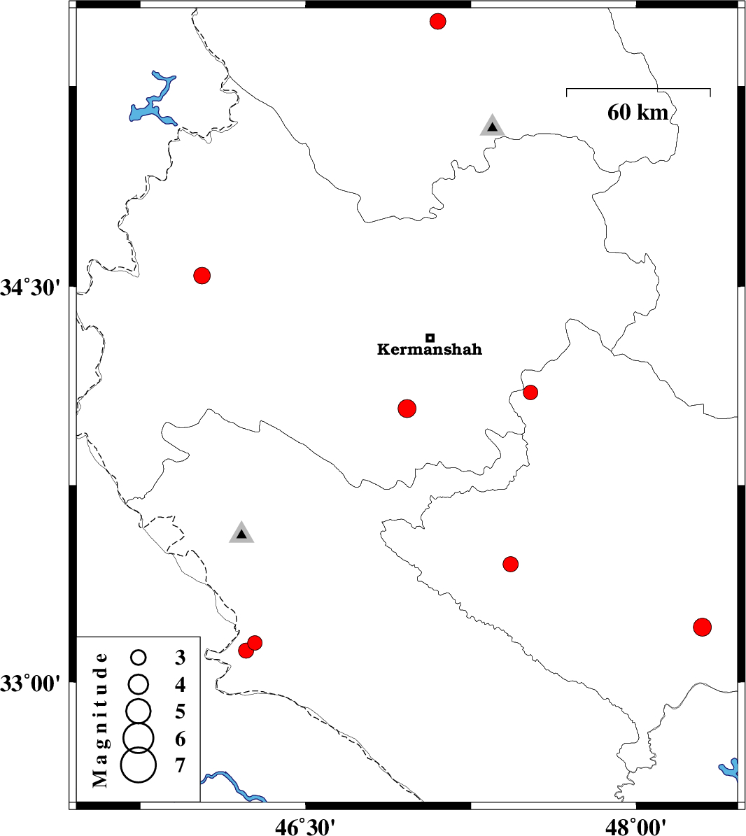
| 2009/10/10 | 11:42:57.3 | 15:12:57.3 | 34.04 | 46.96 | 14 | ML:3.7 | Kermanshah Province, 31 km South-West of Kermanshah | ||
| 2009/09/28 | 07:45:15.3 | 11:15:15.3 | 35.49 | 47.1 | 14 | ML:3.2 | Kordestan Province, 22 km North-East of Sanandaj | ||
| 2009/09/26 | 09:56:56.1 | 13:26:56.1 | 34.54 | 46.03 | 14 | ML:3.4 | Kermanshah Province, 16 km East of Sar-e pol-e zahab | ||
| 2009/09/26 | 03:15:29.3 | 06:45:29.3 | 33.45 | 47.43 | 14 | ML:3.1 | Lorestan Province, 19 km West of Kuhdasht | ||
| 2009/09/25 | 06:10:02.6 | 09:40:02.6 | 33.15 | 46.27 | 14 | ML:3 | Ilam Province, 11 km East of Mehran | ||
| 2009/09/24 | 18:01:10.0 | 21:31:10.0 | 33.21 | 48.3 | 14 | ML:3.7 | Lorestan Province, 31 km South of Khorramabad | ||
| 2009/09/16 | 15:10:49.1 | 19:40:49.1 | 34.1 | 47.52 | 14 | ML:2.9 | Lorestan Province, 20 km South of Harsin | ||
| 2009/09/15 | 08:25:23.7 | 12:55:23.7 | 33.12 | 46.23 | 15 | ML:3.1 | Ilam Province, 6 km Mehran |