
| Prel. Rep. | Date | Time(UTC) | Time(Local) | Lat. | Lon. | Depth | Mag. | Region | Waveform |
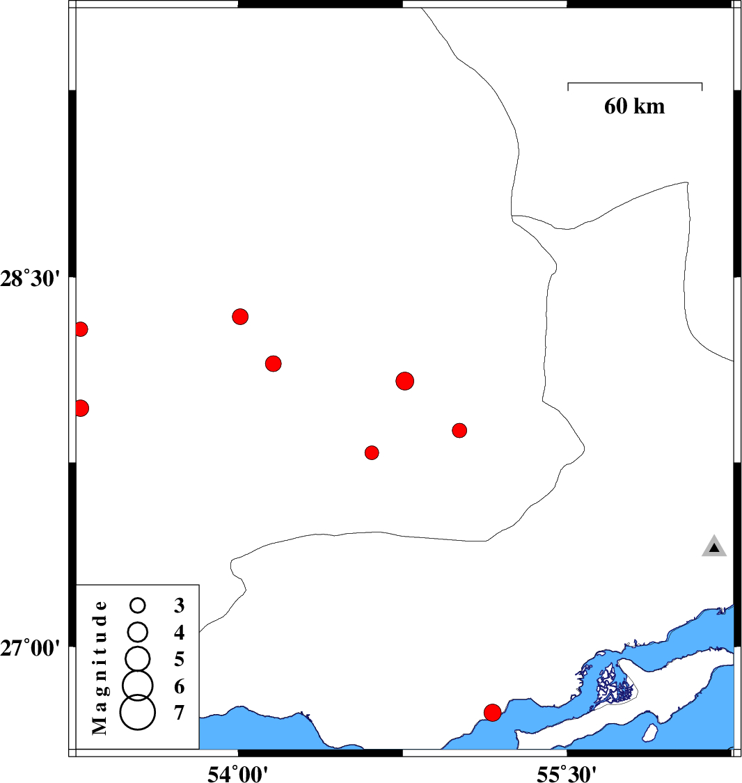
| 2009/08/22 | 04:08:06.7 | 08:38:06.7 | 28.08 | 54.76 | 14 | ML:3.6 | Fars Province, 61 km North-East of Lar | ||
| 2009/08/19 | 16:43:52.2 | 21:13:52.2 | 28.15 | 54.16 | 15 | ML:3.2 | Fars Province, 55 km North-West of Lar | ||
| 2009/08/12 | 07:18:23.1 | 11:48:23.1 | 27.97 | 53.28 | 14 | ML:3.4 | Fars Province, 60 km South-East of Qir va Karzin | ||
| 2009/08/11 | 05:42:44.7 | 10:12:44.7 | 26.73 | 55.16 | 44 | ML:3.5 | Hormozgan Province, 39 km North-East of Bandar-e lengeh | ||
| 2009/08/10 | 12:38:13.2 | 17:08:13.2 | 28.29 | 53.28 | 14 | ML:2.9 | Fars Province, 31 km South-East of Qir va Karzin | ||
| 2009/08/09 | 13:54:26.8 | 18:24:26.8 | 28.34 | 54.01 | 18 | ML:3.2 | Fars Province, 47 km South-East of Jahrom | ||
| 2009/08/06 | 07:36:36.1 | 12:06:36.1 | 27.88 | 55.01 | 14 | ML:3 | Fars Province, 70 km North-East of Lar | ||
| 2009/08/01 | 09:46:03.9 | 14:16:03.9 | 27.79 | 54.61 | 14 | ML:2.8 | Fars Province, 29 km North-East of Lar |