
| Prel. Rep. | Date | Time(UTC) | Time(Local) | Lat. | Lon. | Depth | Mag. | Region | Waveform |
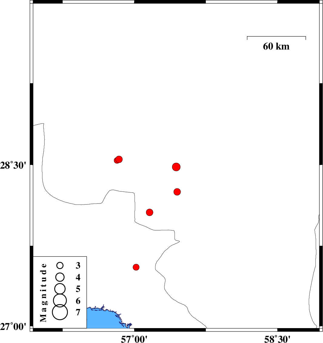
| 2009/07/29 | 23:35:45.9 | 04:05:45.9 | 28.55 | 56.84 | 14 | ML:3.3 | Kerman Province, 79 km South-East of Baft | ||
| 2009/07/29 | 18:09:40.8 | 22:39:40.8 | 28.48 | 57.44 | 14 | ML:3.8 | Kerman Province, 36 km South-West of Jiroft | ||
| 2009/07/25 | 06:48:52.2 | 11:18:52.2 | 28.06 | 57.16 | 46 | ML:3.2 | Kerman Province, 53 km North-West of Kahnuj | ||
| 2009/07/19 | 07:51:10.8 | 12:21:10.8 | 27.55 | 57.02 | 14 | ML:3 | Hormozgan Province, 26 km North-West of Dehbarez | ||
| 2009/07/16 | 05:12:44.6 | 09:42:44.6 | 28.54 | 56.82 | 15 | ML:2.8 | Kerman Province, 80 km South-East of Baft | ||
| 2009/07/05 | 21:51:26.6 | 02:21:26.6 | 28.25 | 57.45 | 14 | ML:3.2 | Kerman Province, 41 km North-West of Kahnuj |