| Prel. Rep. | Date | Time(UTC) | Time(Local) | Lat. | Lon. | Depth | Mag. | Region | Waveform |
|
|
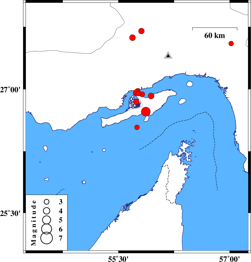
2009/07/22
|
17:44:55.8
|
22:14:55.8
| 26.92 | 55.94 | 28 |
ML:3.7
|
Persian Gulf, 33 km West of Qeshm | |
|
|
2009/07/22
|
09:10:06.1
|
13:40:06.1
| 26.95 | 55.77 | 6 |
ML:3.1
|
Persian Gulf, 49 km West of Qeshm | |
|
|
2009/07/22
|
06:50:00.1
|
11:20:00.1
| 26.96 | 55.74 | 9 |
ML:3.8
|
Persian Gulf, 53 km West of Qeshm | |
|
|
2009/07/22
|
05:46:57.2
|
10:16:57.2
| 26.98 | 55.76 | 7 |
ML:3.1
|
Persian Gulf, 50 km West of Qeshm | |
|
|
2009/07/22
|
05:20:49.8
|
09:50:49.8
| 26.54 | 55.75 | 7 |
ML:3
|
Persian Gulf, 90 km East of Bandar-e lengeh | |
|
|
2009/07/22
|
04:32:49.9
|
09:02:49.9
| 26.94 | 55.82 | 8 |
ML:3.2
|
Persian Gulf, 44 km West of Qeshm | |
|
|
2009/07/22
|
04:26:32.5
|
08:56:32.5
| 26.85 | 55.74 | 6 |
ML:3.5
|
Persian Gulf, 53 km South-West of Qeshm | |
|
|
2009/07/22
|
03:53:02.6
|
08:23:02.6
| 26.73 | 55.87 | 14 |
Mb:5.5
|
Persian Gulf, 47 km South-West of Qeshm | |
|
|
2009/07/19
|
07:51:10.8
|
12:21:10.8
| 27.55 | 57.02 | 14 |
ML:3
|
Hormozgan Province, 26 km North-West of Dehbarez | |
|
|
2009/07/03
|
05:34:40.3
|
10:04:40.3
| 27.7 | 55.81 | 14 |
ML:3.5
|
Hormozgan Province, 68 km South of Hajiabad | |
|
|
2009/07/02
|
21:06:15.0
|
01:36:15.0
| 27.62 | 55.69 | 15 |
ML:3.6
|
Hormozgan Province, 79 km South-West of Hajiabad | |
