
| Prel. Rep. | Date | Time(UTC) | Time(Local) | Lat. | Lon. | Depth | Mag. | Region | Waveform |
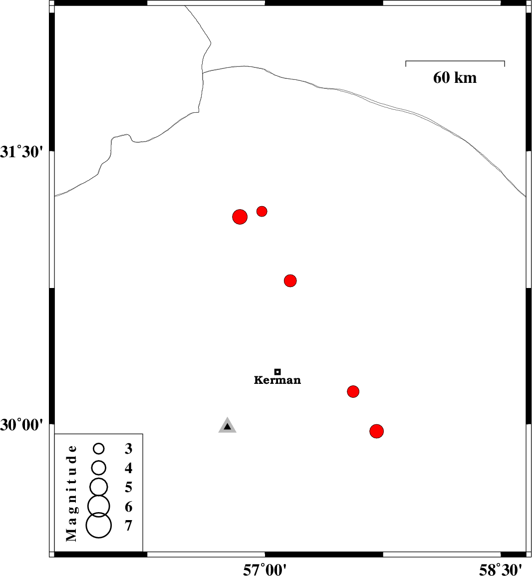
| 2009/07/18 | 14:24:31.9 | 18:54:31.9 | 30.79 | 57.16 | 15 | ML:3.5 | Kerman Province, 56 km North of Kerman | ||
| 2009/07/10 | 20:30:46.7 | 01:00:46.7 | 31.17 | 56.98 | 35 | ML:3 | Kerman Province, 19 km East of Ravar | ||
| 2009/07/06 | 12:01:27.0 | 16:31:27.0 | 30.18 | 57.56 | 15 | ML:3.4 | Kerman Province, 48 km South-East of Kerman | ||
| 2009/06/26 | 15:49:46.4 | 20:19:46.4 | 31.14 | 56.84 | 15 | ML:4.2 | 13 km South of Ravar, Kerman Province | ||
| 2009/06/24 | 20:50:22.0 | 01:20:22.0 | 29.96 | 57.71 | 18 | ML:4 | 70 km South-East of Kerman, Kerman Province |