
| Prel. Rep. | Date | Time(UTC) | Time(Local) | Lat. | Lon. | Depth | Mag. | Region | Waveform |
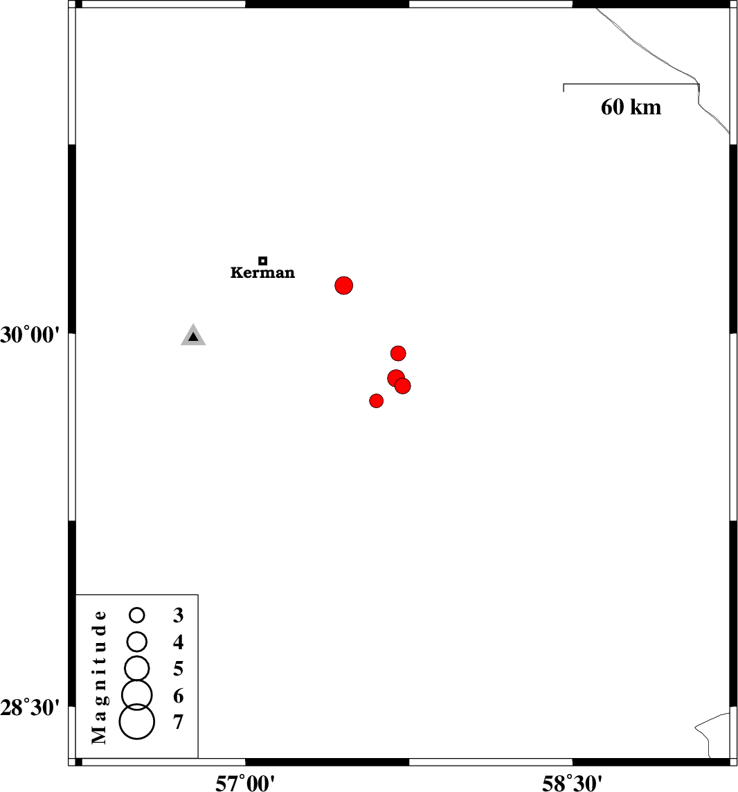
| 2009/06/11 | 12:45:35.0 | 17:15:35.0 | 29.79 | 57.72 | 6 | ML:3.2 | 82 km South-East of Kerman, Kerman Province | ||
| 2009/06/11 | 12:38:20.7 | 17:08:20.7 | 29.82 | 57.69 | 14 | ML:3.5 | 78 km South-East of Kerman, Kerman Province | ||
| 2009/06/10 | 00:23:58.3 | 04:53:58.3 | 28.55 | 56.72 | 14 | ML:3.3 | 76 km South-East of Baft, Kerman Province | ||
| 2009/06/05 | 13:20:26.5 | 17:50:26.5 | 29.92 | 57.7 | 14 | ML:3.1 | 72 km South-East of Kerman, Kerman Province | ||
| 2009/05/29 | 03:43:05.7 | 08:13:05.7 | 29.73 | 57.6 | 14 | ML:2.8 | 79 km South-East of Kerman, Kerman Province | ||
| 2009/05/12 | 06:30:51.3 | 11:00:51.3 | 30.19 | 57.45 | 7 | ML:3.7 | 37 km South-East of Kerman, Kerman Province |