
| Prel. Rep. | Date | Time(UTC) | Time(Local) | Lat. | Lon. | Depth | Mag. | Region | Waveform |
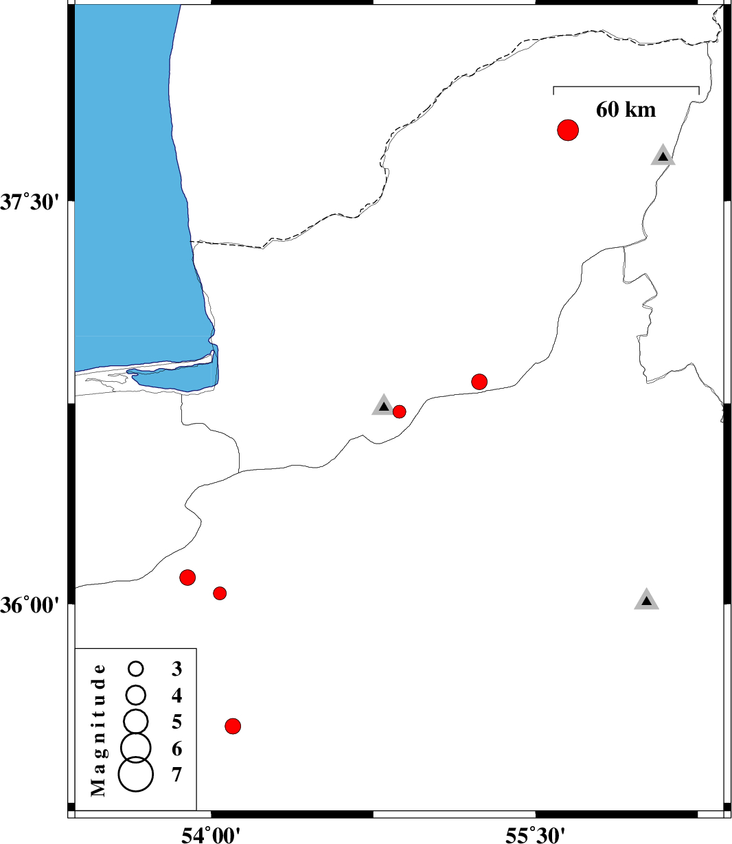
| 2008/08/11 | 14:32:21.2 | 19:02:21.2 | 36.72 | 54.87 | 14 | ML:2.7 | 21 km South of Ali Abad, Golestan Province | ||
| 2008/08/10 | 00:29:49.6 | 04:59:49.6 | 36.83 | 55.24 | 15 | ML:3.3 | 21 km South of Ramian, Golestan Province | ||
| 2008/08/06 | 23:16:22.5 | 03:46:22.5 | 36.1 | 53.89 | 15 | ML:3.2 | 41 km West of Damghan, Semnan Province | ||
| 2008/08/01 | 22:44:38.5 | 03:14:38.5 | 37.76 | 55.65 | 15 | ML:4.4 | 44 km North-East of Kalaleh, Golestan Province | ||
| 2008/08/01 | 02:07:55.8 | 06:37:55.8 | 36.04 | 54.04 | 42 | ML:2.7 | 31 km South-West of Damghan, Semnan Province | ||
| 2008/07/28 | 02:37:26.8 | 07:07:26.8 | 35.35 | 53.4 | 14 | ML:2.8 | 23 km South of Semnan, Semnan Province | ||
| 2008/07/25 | 19:29:42.1 | 23:59:42.1 | 35.46 | 53.8 | 15 | ML:2.9 | 37 km South-East of Semnan, Semnan Province | ||
| 2008/07/15 | 03:54:42.4 | 08:24:42.4 | 35.54 | 54.1 | 34 | ML:3.2 | 63 km East of Semnan, Semnan Province |