
| Prel. Rep. | Date | Time(UTC) | Time(Local) | Lat. | Lon. | Depth | Mag. | Region | Waveform |
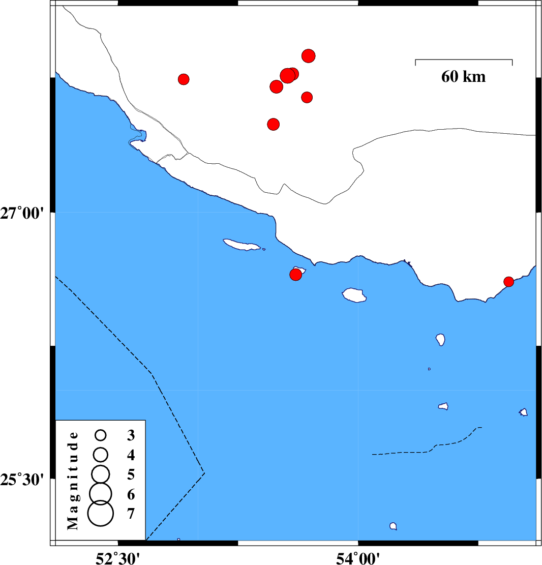
| 2008/02/11 | 19:10:37.2 | 22:40:37.2 | 26.65 | 53.61 | 39 | ML:3.4 | Persian Gulf, 87 km South-East of Lamerd | ||
| 2008/02/10 | 15:31:10.8 | 19:01:10.8 | 27.64 | 53.68 | 33 | ML:3.1 | 61 km North-East of Lamerd, Fars Province | ||
| 2008/02/10 | 02:12:21.3 | 05:42:21.3 | 26.61 | 54.94 | 35 | ML:2.8 | 13 km Bandar-e lengeh, Hormozgan Province | ||
| 2008/02/08 | 15:49:07.5 | 19:19:07.5 | 27.87 | 53.69 | 18 | ML:3.8 | 67 km North-West of Lar, Fars Province | ||
| 2008/02/07 | 20:48:39.4 | 00:18:39.4 | 27.74 | 52.91 | 14 | ML:3.1 | 21 km North of Mehr, Fars Province | ||
| 2008/02/07 | 20:20:07.8 | 23:50:07.8 | 27.49 | 53.47 | 46 | ML:3.4 | 34 km North-East of Lamerd, Fars Province | ||
| 2008/02/07 | 20:15:26.2 | 23:45:26.2 | 27.76 | 53.56 | 44 | ML:4.3 | 60 km North-East of Lamerd, Fars Province | ||
| 2008/02/07 | 18:55:26.6 | 22:25:26.6 | 27.7 | 53.49 | 43 | ML:3.7 | 51 km North-East of Lamerd, Fars Province | ||
| 2008/02/04 | 18:12:41.4 | 21:42:41.4 | 27.77 | 53.59 | 40 | ML:3.5 | 63 km North-East of Lamerd, Fars Province |