
| Prel. Rep. | Date | Time(UTC) | Time(Local) | Lat. | Lon. | Depth | Mag. | Region | Waveform |
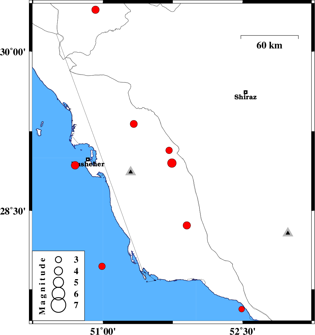
| 2008/01/28 | 01:20:20.3 | 04:50:20.3 | 28.95 | 51.74 | 41 | ML:4.3 | 34 km West of Farashband, Fars Province | ||
| 2008/01/25 | 04:46:55.8 | 08:16:55.8 | 29.07 | 51.71 | 15 | ML:3.3 | 42 km North-West of Farashband, Fars Province | ||
| 2008/01/23 | 11:21:25.9 | 14:51:25.9 | 28.93 | 50.7 | 45 | ML:3.8 | Persian Gulf, 14 km West of Busheher | ||
| 2008/01/21 | 08:24:08.1 | 11:54:08.1 | 30.39 | 50.92 | 15 | ML:3.6 | 13 km East of Dogonbadan, Kohkiluieh va boyerahmad Province | ||
| 2008/01/13 | 14:30:44.7 | 18:00:44.7 | 29.32 | 51.33 | 18 | ML:3.5 | 13 km East of Borazjan, Bushehr Province | ||
| 2008/01/09 | 22:27:31.0 | 01:57:31.0 | 28.36 | 51.9 | 6 | ML:3.7 | 59 km South-West of Farashband, Fars Province | ||
| 2008/01/05 | 03:31:42.8 | 07:01:42.8 | 27.97 | 50.99 | 18 | ML:3.3 | Persian Gulf, 84 km South-West of Khormog | ||
| 2007/12/29 | 02:58:43.4 | 06:28:43.4 | 27.56 | 52.49 | 31 | ML:2.8 | Persian Gulf, 35 km South-East of Jam |