| Prel. Rep. | Date | Time(UTC) | Time(Local) | Lat. | Lon. | Depth | Mag. | Region | Waveform |
|
|
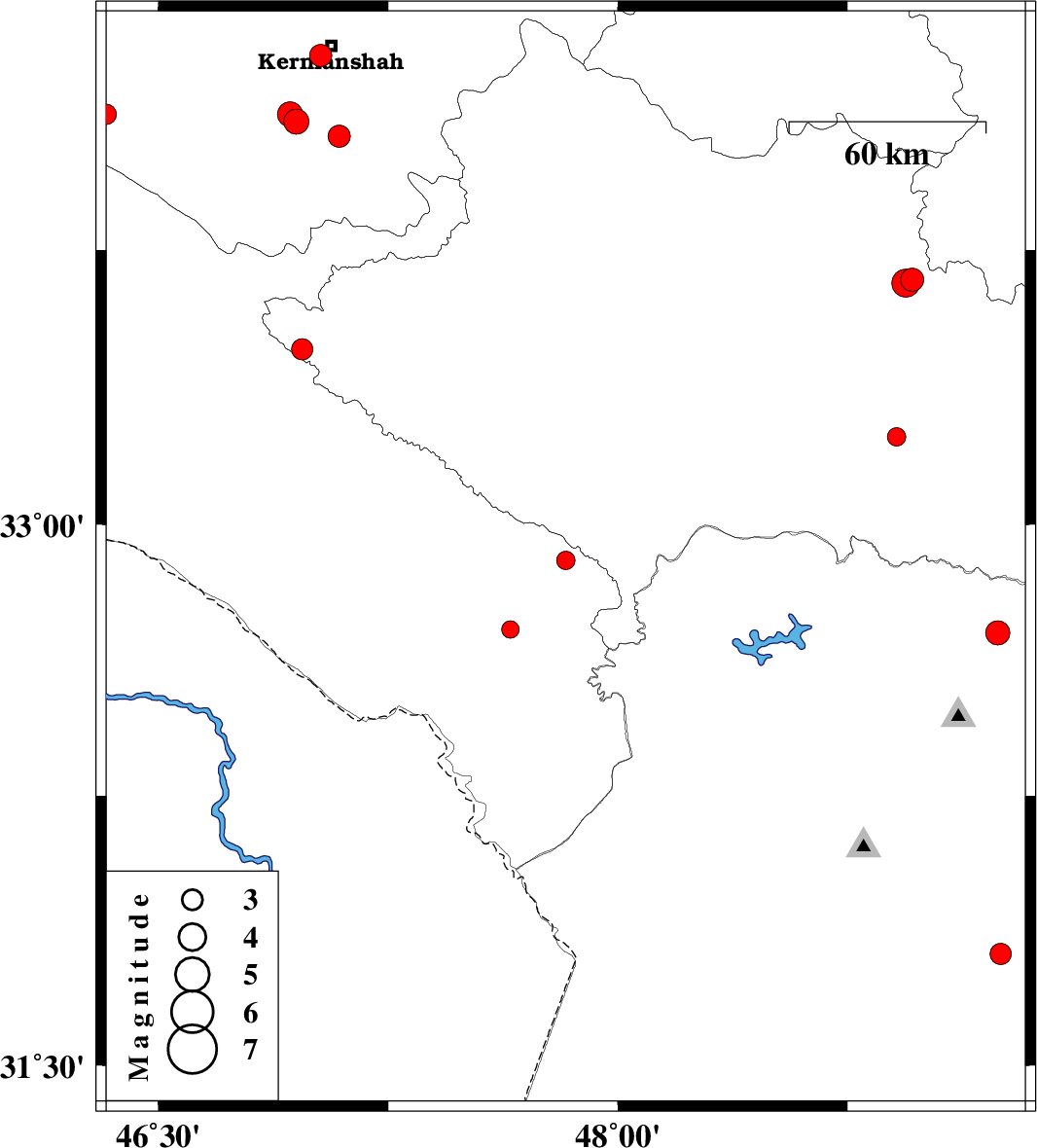
2007/12/06
|
13:53:39.1
|
17:23:39.1
| 32.9 | 47.83 | 14 |
ML:2.7
|
29 km South-East of Pol-e dokhtar, Lorestan Province | |
|
|
2007/12/04
|
22:12:03.8
|
01:42:03.8
| 31.81 | 49.25 | 16 |
ML:3.1
|
14 km South of Masjed Soleyman, Khoozestan Province | |
|
|
2007/12/02
|
04:20:38.0
|
07:50:38.0
| 34.06 | 47.09 | 14 |
ML:3.2
|
27 km South of Kermanshah, Kermanshah Province | |
|
|
2007/12/01
|
20:06:37.0
|
23:36:37.0
| 34.28 | 47.03 | 14 |
ML:3.3
|
4 km Kermanshah, Kermanshah Province | |
|
|
2007/11/30
|
23:39:59.9
|
03:09:59.9
| 34.1 | 46.95 | 15 |
ML:3.7
|
25 km South-West of Kermanshah, Kermanshah Province | |
|
|
2007/11/29
|
01:10:47.4
|
04:40:47.4
| 34.12 | 46.93 | 15 |
ML:3.7
|
23 km South-West of Kermanshah, Kermanshah Province | |
|
|
2007/11/20
|
11:36:16.4
|
15:06:16.4
| 32.7 | 49.24 | 14 |
ML:3.5
|
36 km North-East of Lali, Khoozestan Province | |
|
|
2007/11/14
|
08:27:44.9
|
11:57:44.9
| 34.12 | 46.33 | 18 |
ML:3
|
24 km West of Eslam Abad-E-Gharb, Kermanshah Province | |
|
|
2007/11/12
|
21:14:07.7
|
00:44:07.7
| 33.24 | 48.91 | 14 |
ML:2.7
|
30 km South-West of Dorud, Lorestan Province | |
|
|
2007/11/11
|
11:06:46.1
|
14:36:46.1
| 32.71 | 47.65 | 14 |
ML:2.6
|
29 km South-East of Abdanan, Ilam Province | |
|
|
2007/11/08
|
09:45:44.5
|
13:15:44.5
| 33.67 | 48.96 | 14 |
ML:3.4
|
22 km North-West of Dorud, Lorestan Province | |
|
|
2007/11/08
|
09:40:37.7
|
13:10:37.7
| 33.66 | 48.94 | 15 |
ML:4.1
|
23 km North-West of Dorud, Lorestan Province | |
|
|
2007/11/07
|
03:32:10.7
|
07:02:10.7
| 33.48 | 46.97 | 14 |
ML:3.1
|
50 km North-West of Darreh Shahr, Ilam Province | |
