
| Prel. Rep. | Date | Time(UTC) | Time(Local) | Lat. | Lon. | Depth | Mag. | Region | Waveform |
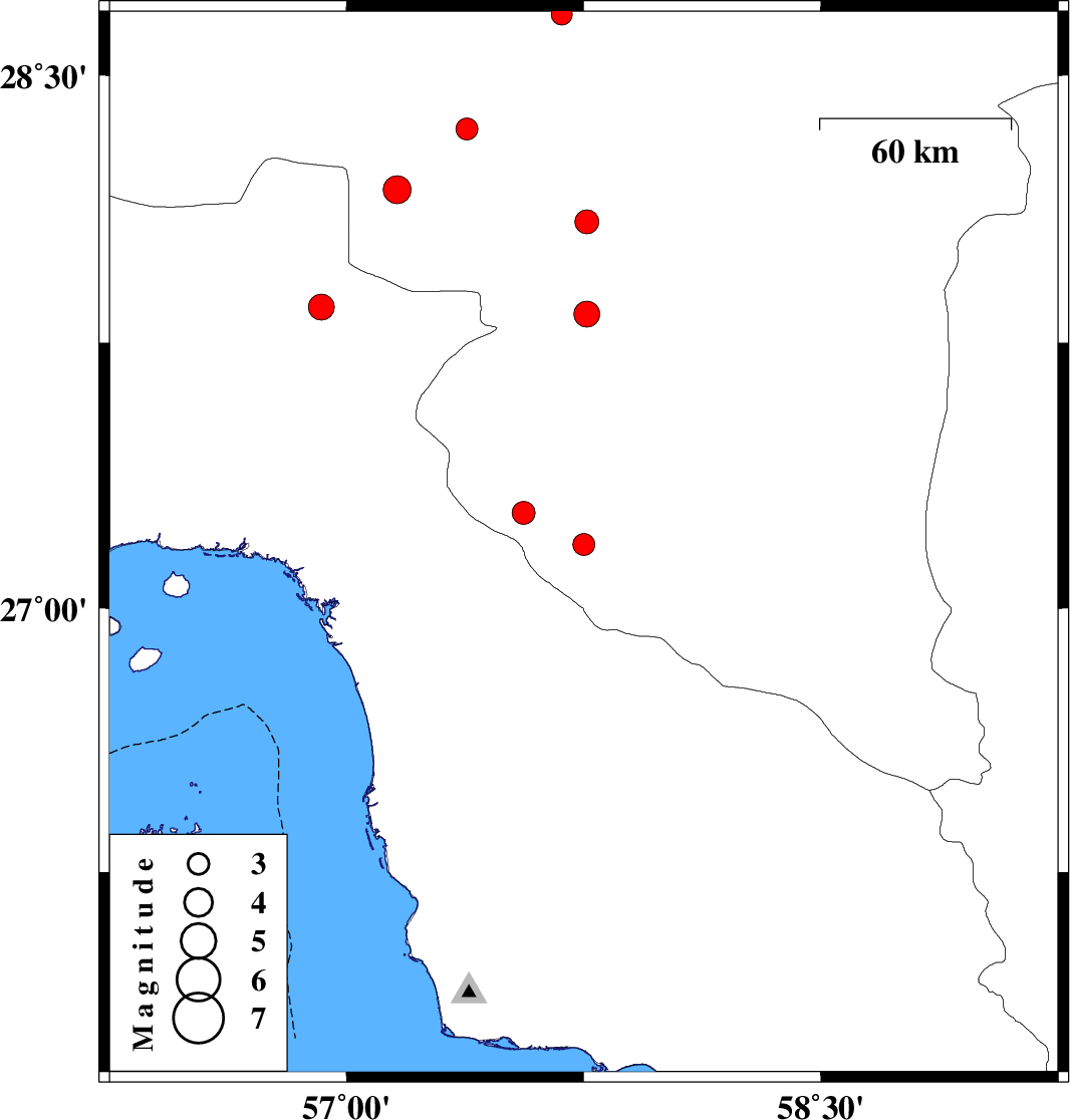
| 2007/08/01 | 08:00:36.3 | 11:30:36.3 | 27.18 | 57.75 | 14 | ML:3.1 | 35 km South-East of Manujan, Kerman Province | ||
| 2007/07/31 | 11:04:19.6 | 14:34:19.6 | 27.83 | 57.76 | 14 | ML:3.6 | 14 km South of Kahnuj, Kerman Province | ||
| 2007/07/26 | 11:40:11.1 | 15:10:11.1 | 28.09 | 57.76 | 14 | ML:3.4 | 17 km North of Kahnuj, Kerman Province | ||
| 2007/07/25 | 19:46:00.3 | 23:16:00.3 | 28.35 | 57.38 | 14 | ML:3.1 | 49 km South-West of Jiroft, Kerman Province | ||
| 2007/07/16 | 17:25:51.2 | 20:55:51.2 | 28.18 | 57.16 | 28 | ML:4 | 58 km North-West of Kahnuj, Kerman Province | ||
| 2007/07/10 | 09:02:33.1 | 12:32:33.1 | 27.27 | 57.56 | 26 | ML:3.2 | 17 km South of Manujan, Kerman Province | ||
| 2007/07/09 | 01:11:11.3 | 04:41:11.3 | 27.85 | 56.92 | 38 | ML:3.6 | 56 km North-West of Dehbarez, Hormozgan Province | ||
| 2007/07/02 | 21:44:29.0 | 01:14:29.0 | 28.67 | 57.68 | 18 | ML:3 | 6 km Jiroft, Kerman Province |