
| Prel. Rep. | Date | Time(UTC) | Time(Local) | Lat. | Lon. | Depth | Mag. | Region | Waveform |
| 2007/05/30 | 11:23:30.9 | 14:53:30.9 | 27.41 | 52.73 | 15 | ML:2.8 | 21 km South-West of Mehr, Fars Province | ||
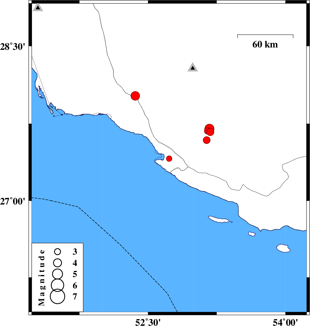
| 2007/05/24 | 21:51:37.9 | 01:21:37.9 | 28.02 | 52.36 | 18 | ML:4.4 | 21 km North of Jam, Bushehr Province | ||
| 2007/05/18 | 23:47:09.5 | 03:17:09.5 | 27.67 | 53.18 | 24 | ML:3.7 | 31 km North-East of Mehr, Fars Province | ||
| 2007/05/18 | 23:24:54.1 | 02:54:54.1 | 27.59 | 53.14 | 23 | ML:3.5 | 25 km East of Mehr, Fars Province | ||
| 2007/05/18 | 23:22:28.9 | 02:52:28.9 | 27.68 | 53.15 | 31 | ML:3.2 | 29 km North-East of Mehr, Fars Province | ||
| 2007/05/18 | 23:03:34.1 | 02:33:34.1 | 27.7 | 53.17 | 31 | ML:4.7 | 32 km North-East of Mehr, Fars Province |