
| Prel. Rep. | Date | Time(UTC) | Time(Local) | Lat. | Lon. | Depth | Mag. | Region | Waveform |
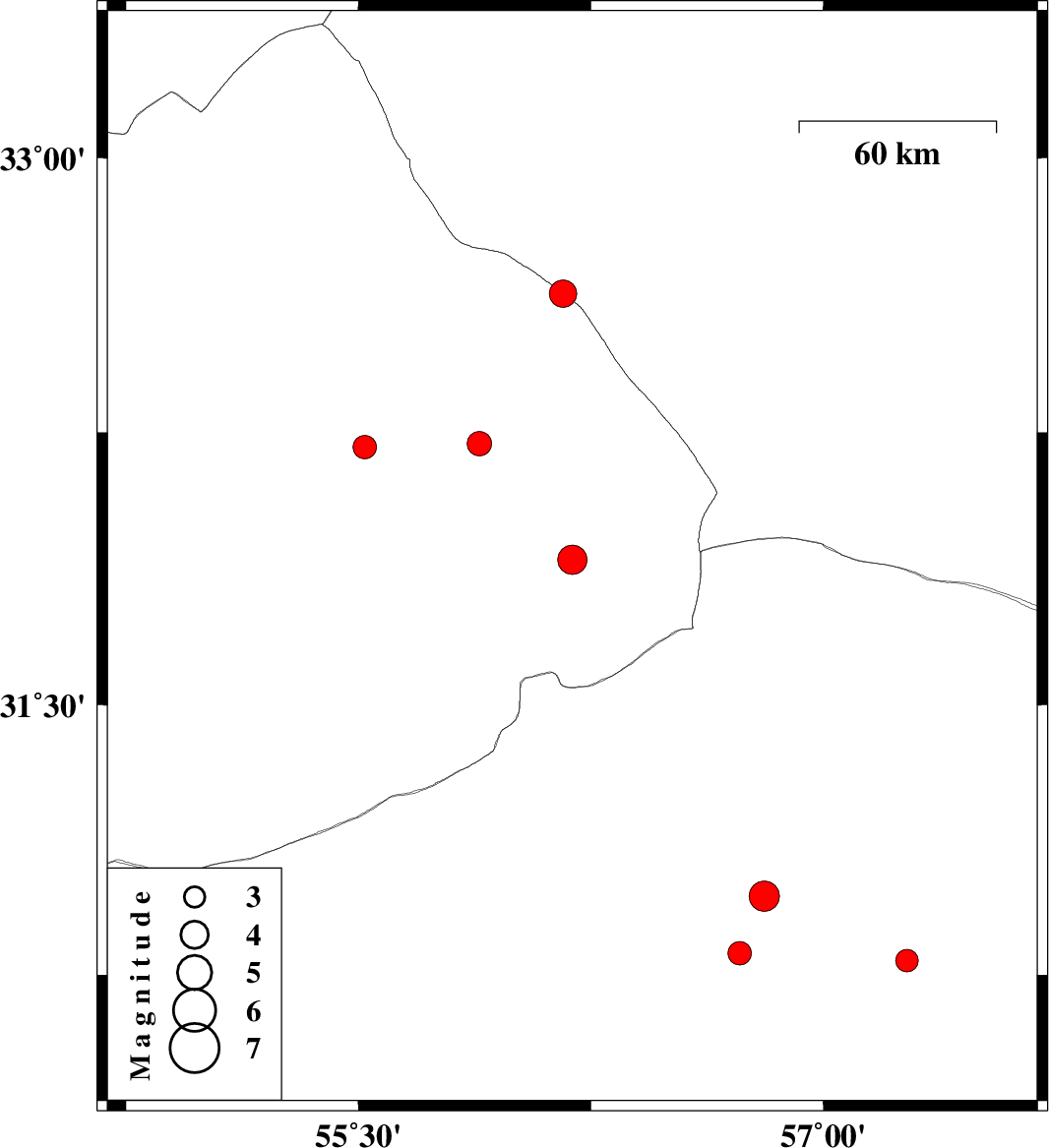
| 2007/05/08 | 14:22:49.9 | 17:52:49.9 | 32.63 | 56.16 | 14 | ML:3.9 | 129 km South-West of Tabas, Yazd Province | ||
| 2007/05/08 | 03:28:24.3 | 06:58:24.3 | 31.9 | 56.19 | 14 | ML:4.2 | 82 km North-East of Bafq, Yazd Province | ||
| 2007/05/03 | 00:03:23.1 | 03:33:23.1 | 32.21 | 55.52 | 14 | ML:3.4 | 68 km North-East of Bafq, Yazd Province | ||
| 2007/04/26 | 03:45:20.4 | 07:15:20.4 | 30.81 | 56.73 | 7 | ML:3.4 | 15 km East of Zarand, Kerman Province | ||
| 2007/04/14 | 13:06:40.3 | 16:36:40.3 | 30.79 | 57.27 | 15 | ML:3.2 | 59 km North-East of Kerman, Kerman Province | ||
| 2007/04/12 | 12:59:41.7 | 16:29:41.7 | 32.22 | 55.89 | 15 | ML:3.5 | 83 km North-East of Bafq, Yazd Province | ||
| 2007/04/08 | 11:22:21.5 | 14:52:21.5 | 30.97 | 56.81 | 15 | ML:4.4 | 28 km North-East of Zarand, Kerman Province |