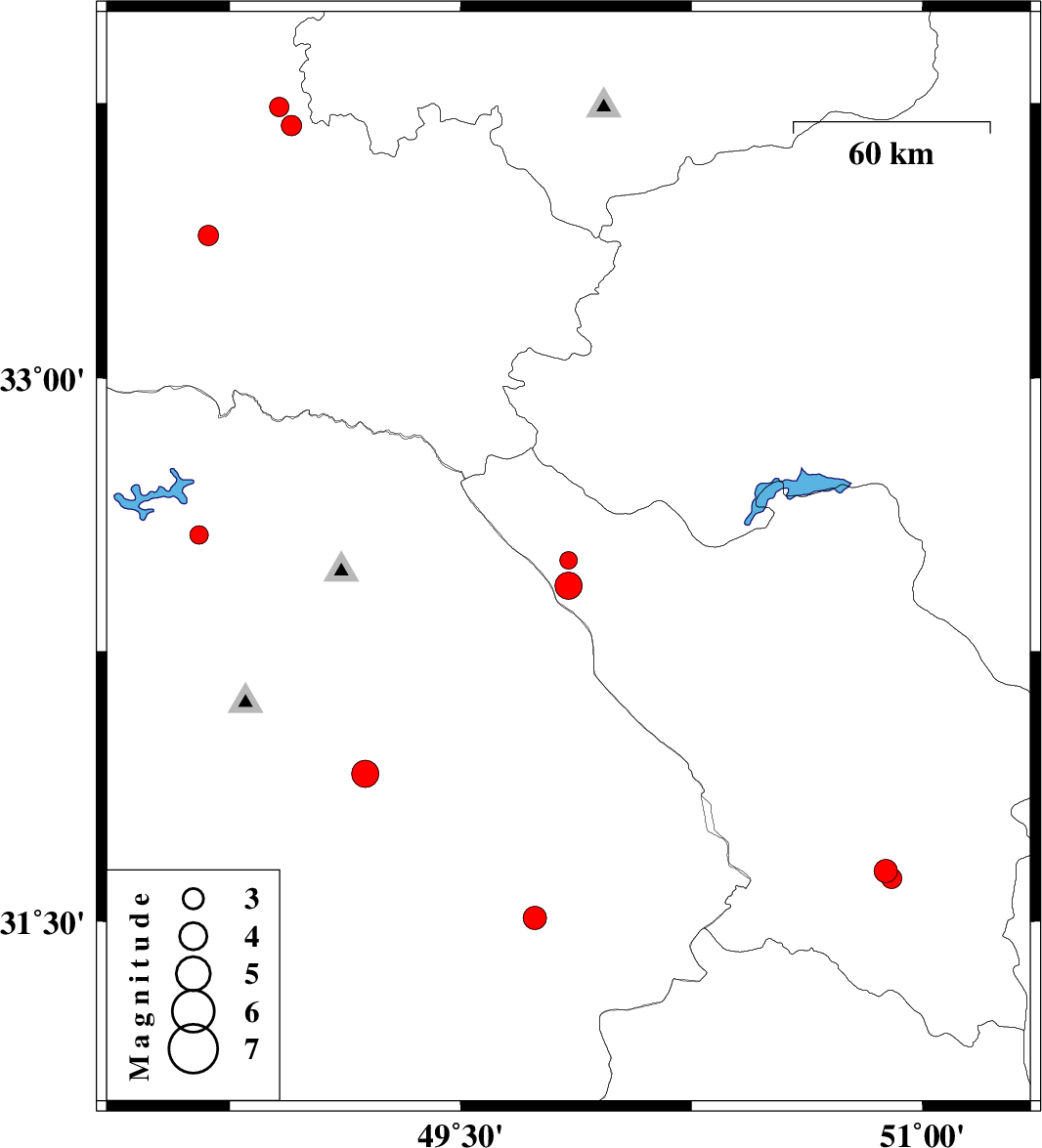
| Prel. Rep. | Date | Time(UTC) | Time(Local) | Lat. | Lon. | Depth | Mag. | Region | Waveform |
|
|
2006/11/11
|
12:21:08.3
|
15:51:08.3
| 32.5 | 49.85 | 15 |
ML:2.6
|
26 km West of Chelgard, Chaharmahal Bakhtiari Province | |
|
|
2006/11/11
|
02:19:33.9
|
05:49:33.9
| 32.43 | 49.85 | 18 |
ML:4
|
25 km West of Chelgard, Chaharmahal Bakhtiari Province | |
|
|
2006/11/07
|
08:52:21.4
|
12:22:21.4
| 31.91 | 49.19 | 16 |
ML:4
|
11 km West of Masjed Soleyman, Khoozestan Province | |
|
|
2006/10/28
|
19:03:48.4
|
22:33:48.4
| 33.39 | 48.68 | 18 |
ML:2.9
|
30 km East of Khorramabad, Lorestan Province | |
|
|
2006/10/26
|
22:37:36.0
|
02:07:36.0
| 31.64 | 50.88 | 18 |
ML:3.4
|
17 km North of Lordegan, Chaharmahal Bakhtiari Province | |
|
|
2006/10/26
|
22:26:38.4
|
01:56:38.4
| 31.62 | 50.9 | 18 |
ML:3
|
15 km North of Lordegan, Chaharmahal Bakhtiari Province | |
|
|
2006/10/24
|
00:21:01.8
|
03:51:01.8
| 33.69 | 48.95 | 14 |
ML:2.9
|
26 km North-West of Dorud, Lorestan Province | |
|
|
2006/10/20
|
16:15:42.8
|
19:45:42.8
| 32.57 | 48.65 | 14 |
ML:2.7
|
30 km North-East of Andimeshk, Khoozestan Province | |
|
|
2006/10/15
|
03:37:49.6
|
07:07:49.6
| 33.74 | 48.91 | 14 |
ML:2.8
|
22 km South-East of Borujerd, Lorestan Province | |
|
|
2006/10/12
|
18:03:29.5
|
21:33:29.5
| 31.51 | 49.74 | 38 |
ML:3.4
|
14 km West of Bagh Malek, Khoozestan Province | |
