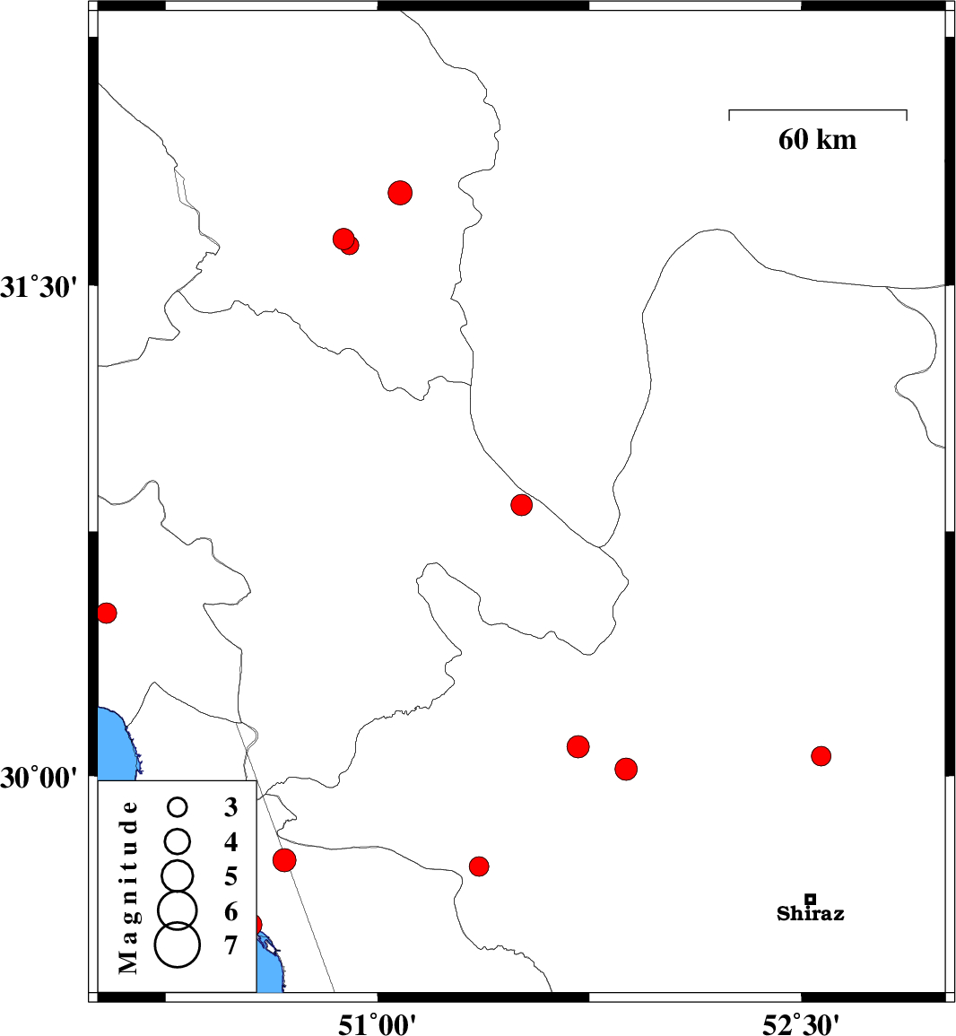
| Prel. Rep. | Date | Time(UTC) | Time(Local) | Lat. | Lon. | Depth | Mag. | Region | Waveform |
|
|
2006/11/02
|
21:22:07.9
|
00:52:07.9
| 30.06 | 52.57 | 14 |
ML:3.1
|
30 km North-West of Marvdasht, Fars Province | |
|
|
2006/11/02
|
12:30:30.9
|
16:00:30.9
| 30.83 | 51.51 | 14 |
ML:3.4
|
6 km Sisakht, Kohkiluieh va boyerahmad Province | |
|
|
2006/10/31
|
08:40:53.1
|
12:10:53.1
| 30.5 | 50.04 | 16 |
ML:3.2
|
22 km West of Behbahan, Khoozestan Province | |
|
|
2006/10/26
|
22:37:36.0
|
02:07:36.0
| 31.64 | 50.88 | 18 |
ML:3.4
|
17 km North of Lordegan, Chaharmahal Bakhtiari Province | |
|
|
2006/10/26
|
22:26:38.4
|
01:56:38.4
| 31.62 | 50.9 | 18 |
ML:3
|
15 km North of Lordegan, Chaharmahal Bakhtiari Province | |
|
|
2006/10/23
|
09:01:26.5
|
12:31:26.5
| 29.74 | 50.67 | 17 |
ML:3.6
|
23 km North-East of Bandar-e genaveh, Bushehr Province | |
|
|
2006/10/22
|
21:54:18.9
|
01:24:18.9
| 29.54 | 50.55 | 43 |
ML:3.6
|
Persian Gulf, 4 km Bandar-e genaveh | |
|
|
2006/10/20
|
23:18:51.5
|
02:48:51.5
| 30.09 | 51.71 | 15 |
ML:3.5
|
18 km East of Nurabad, Fars Province | |
|
|
2006/10/17
|
04:03:25.6
|
07:33:25.6
| 30.02 | 51.88 | 18 |
ML:3.5
|
29 km South-West of Ardakan, Fars Province | |
|
|
2006/10/11
|
21:01:45.8
|
00:31:45.8
| 29.72 | 51.36 | 15 |
ML:3.1
|
30 km West of Kazerun, Fars Province | |
|
|
2006/10/10
|
03:32:15.1
|
07:02:15.1
| 31.78 | 51.08 | 14 |
ML:3.8
|
29 km South-West of Borujen, Chaharmahal Bakhtiari Province | |
