| Prel. Rep. | Date | Time(UTC) | Time(Local) | Lat. | Lon. | Depth | Mag. | Region | Waveform |
|
|
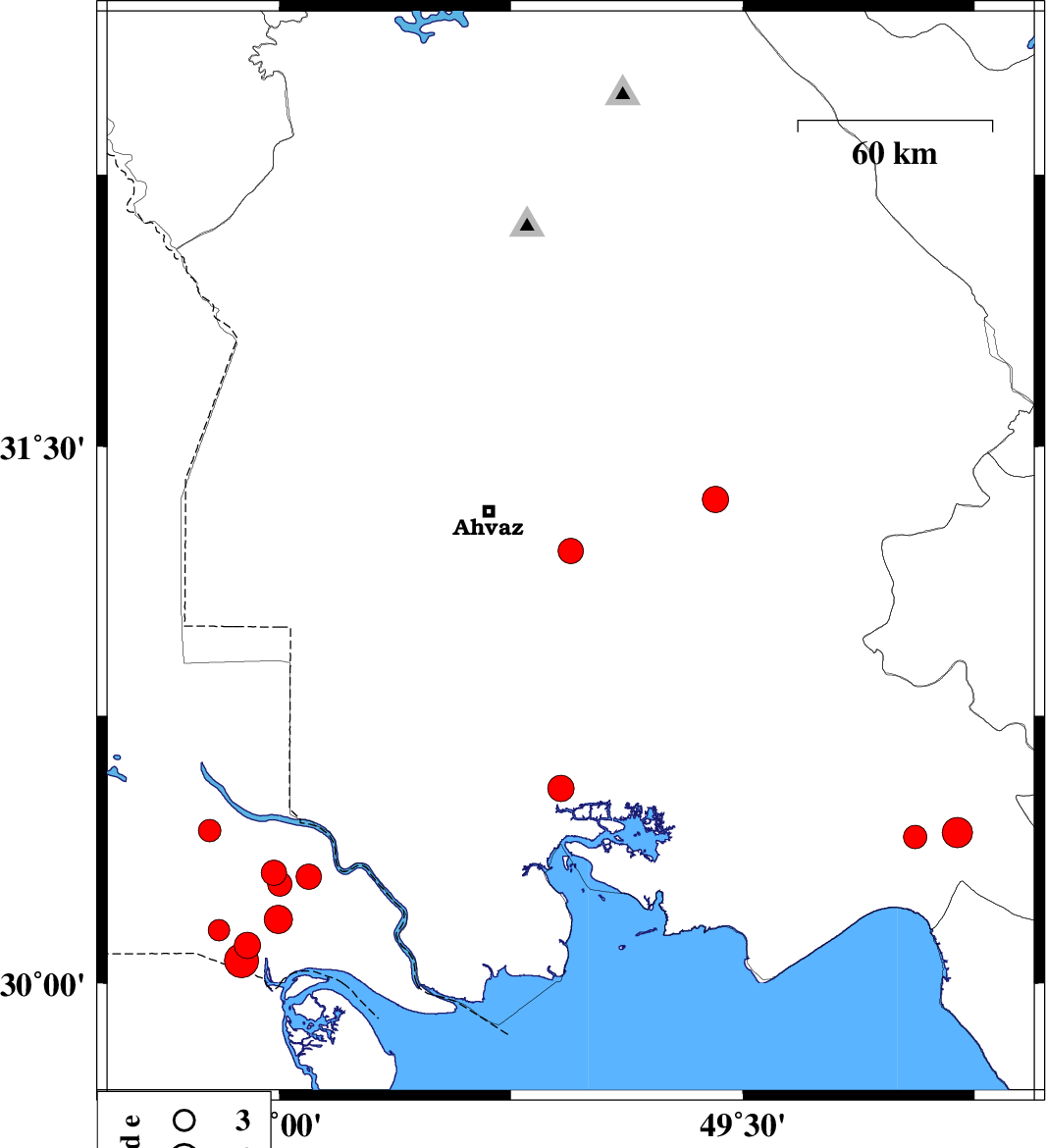
2026/02/03
|
19:38:22.1
|
23:08:22.1
| 31.2 | 48.943 | 15 |
ML:3.8
|
Khoozestan Province, 29 km South-East of Ahvaz | |
|
|
2026/02/03
|
19:03:03.4
|
22:33:03.4
| 31.858 | 48.975 | 12 |
ML:3.7
|
Khoozestan Province, 23 km South-East of Shushtar | |
|
|
2026/01/28
|
04:41:07.9
|
08:11:07.9
| 31.082 | 47.807 | 12 |
ML:3.3
|
Khoozestan Province, 62 km North of Al Basrah | |
|
|
2026/01/13
|
06:14:10.1
|
09:44:10.1
| 30.965 | 48.015 | 12 |
ML:3.7
|
, 53 km North-East of Al Basrah | |
|
|
2026/01/12
|
11:11:09.8
|
14:41:09.8
| 30.835 | 48.029 | 12 |
ML:4.1
|
Iraq, 41 km North-East of Al Basrah | |
|
|
2026/01/12
|
09:44:19.8
|
13:14:19.8
| 30.954 | 48.127 | 12 |
ML:3.7
|
Khoozestan Province, 59 km North of Khorramshahr | |
|
|
2026/01/12
|
08:50:01.9
|
12:20:01.9
| 30.933 | 48.034 | 12 |
ML:3.5
|
Khoozestan Province, 51 km North-East of Al Basrah | |
|
|
2026/01/12
|
03:48:28.4
|
07:18:28.4
| 30.762 | 47.929 | 12 |
ML:3.8
|
Iraq, 29 km North-East of Al Basrah | |
|
|
2026/01/12
|
01:54:22.8
|
05:24:22.8
| 30.804 | 47.837 | 12 |
ML:3.1
|
Iraq, 32 km North of Al Basrah | |
|
|
2026/01/11
|
17:02:35.9
|
20:32:35.9
| 30.719 | 47.91 | 12 |
ML:4.9
|
Iraq, 24 km North-East of Al Basrah | |
|
|
2026/01/07
|
05:13:15.1
|
08:43:15.1
| 32 | 49.444 | 12 |
ML:3.8
|
Khoozestan Province, 15 km -East of Masjed Soleyman | |
|
|
2026/01/06
|
15:07:37.5
|
18:37:37.5
| 31.077 | 50.226 | 12 |
ML:4.4
|
Kohkiluieh va boyerahmad Province, 54 km North of Behbahan | |
|
|
2026/01/06
|
12:28:13.9
|
15:58:13.9
| 31.064 | 50.089 | 16 |
ML:3.4
|
Kohkiluieh va boyerahmad Province, 54 km North-West of Behbahan | |
